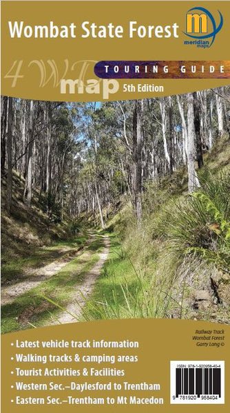
Wombat State Forest 4WD Map
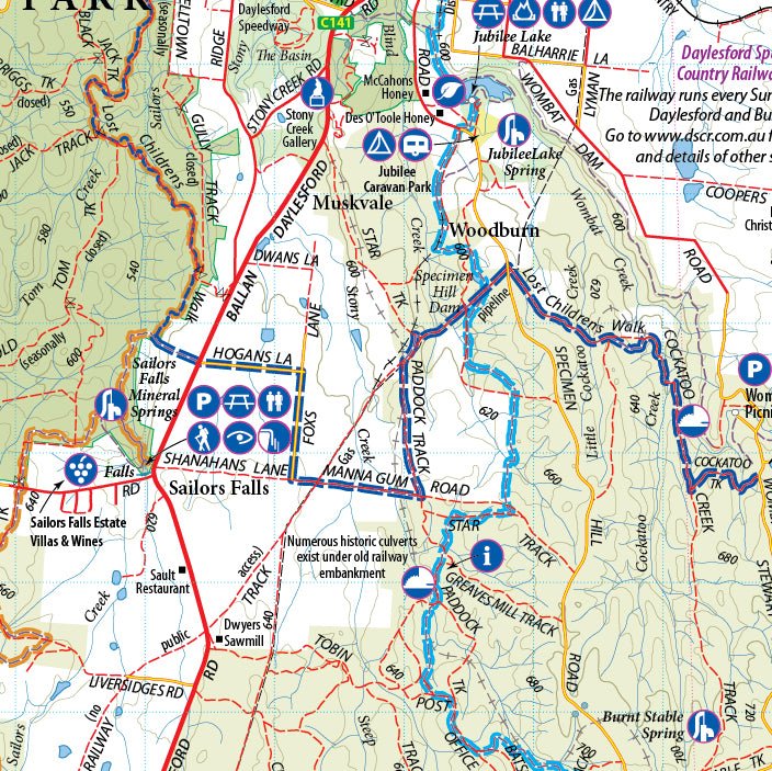
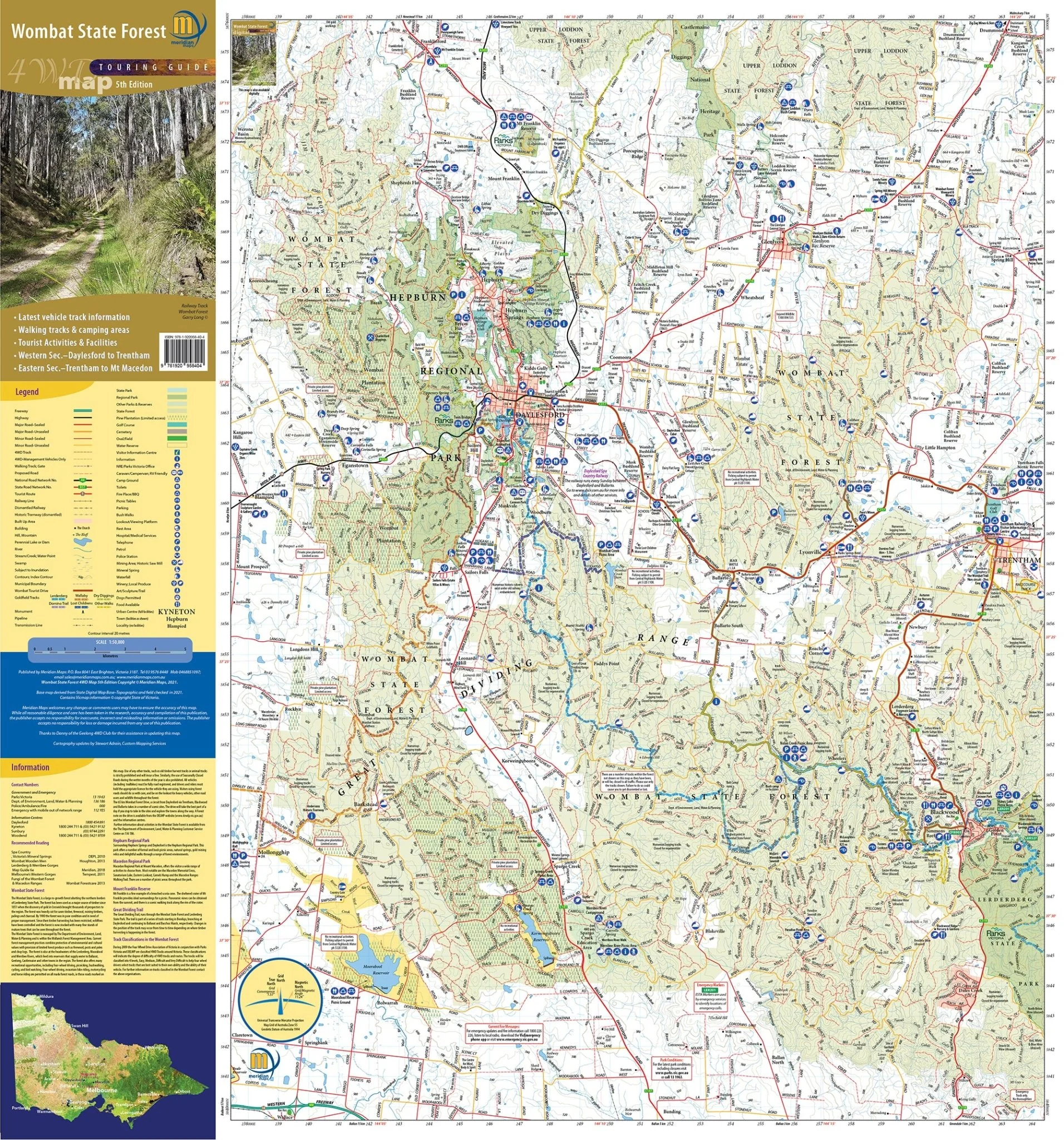
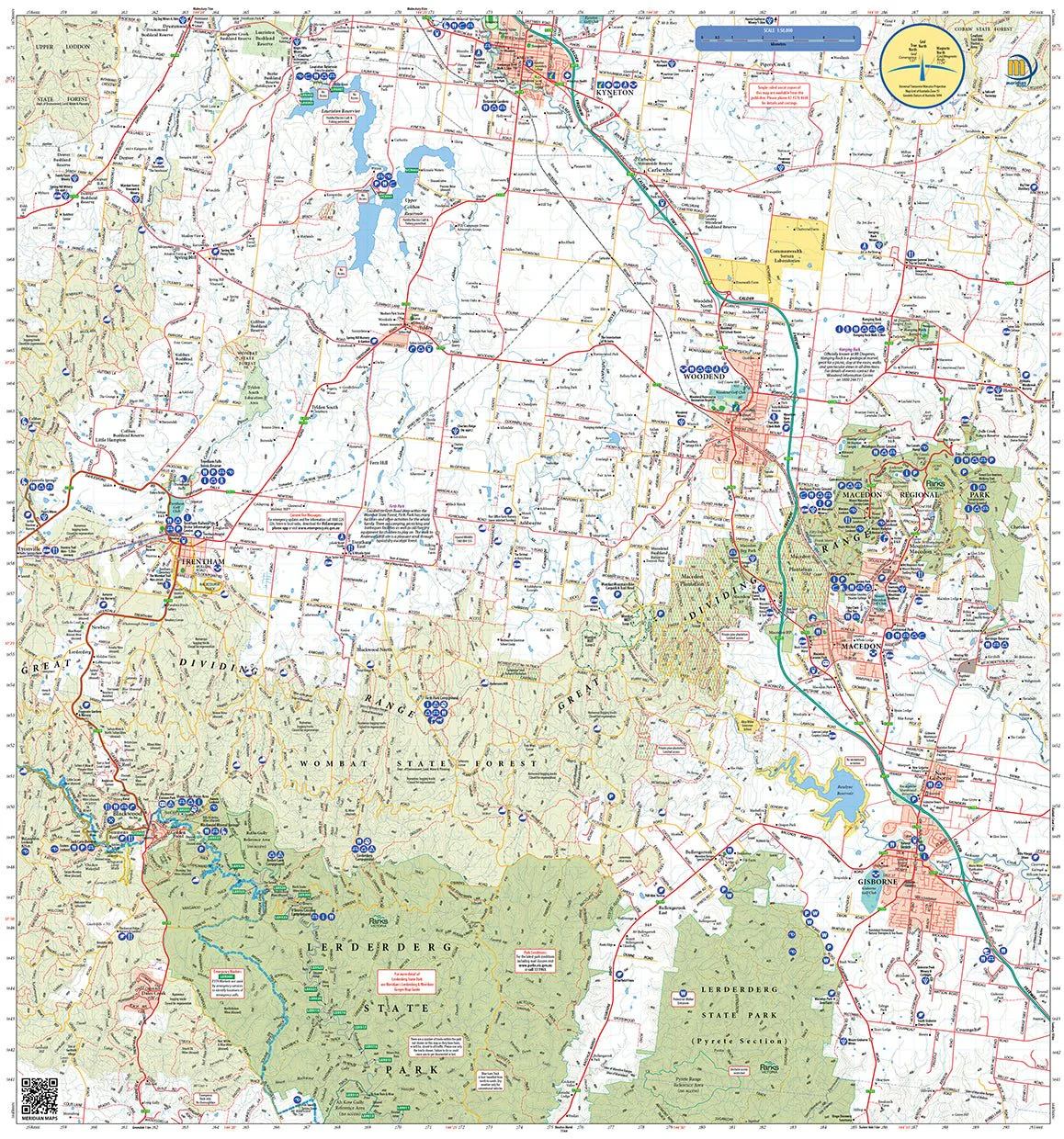
Double-sided 1:50,000 scale map covering the entire Wombat State Forest from Daylesford through to Woodend and the Macedon Ranges. Ideal 4-wheel drive map which highlights all the tourist activities and features of the region such the wineries, mines, mineral spas, picnic grounds and more. Includes the Great Dividing Trail and Wombat Forest Drive. Ideal touring map for four-wheel driving, holidaymakers, bushwalkers and day-trippers. Recently updated to include pet-friendly campgrounds, accommodation, local produce, petrol stations, waterfalls and more tourist information.
Key Features
- 1:50,000 Scale Maps
- Latest vehicles track information
- Walking tracks and camping areas
- Suitable for use with GPS
- Western section: Daylsford to Trentham
- Eastern section: Trentham to Mount Macedon
Key Specifications
Edition: 5th edition
Publication Date: 31/12/21
Scale: 1:50,000
Folded size (WxHxD): 140mm x 250mm x 4mm
Flat size (WxH): 750mm x 700mm
Weight: 0.09kgs
Original: $10.78
-65%$10.78
$3.77More Images
Wombat State Forest 4WD Map
Double-sided 1:50,000 scale map covering the entire Wombat State Forest from Daylesford through to Woodend and the Macedon Ranges. Ideal 4-wheel drive map which highlights all the tourist activities and features of the region such the wineries, mines, mineral spas, picnic grounds and more. Includes the Great Dividing Trail and Wombat Forest Drive. Ideal touring map for four-wheel driving, holidaymakers, bushwalkers and day-trippers. Recently updated to include pet-friendly campgrounds, accommodation, local produce, petrol stations, waterfalls and more tourist information.
Key Features
- 1:50,000 Scale Maps
- Latest vehicles track information
- Walking tracks and camping areas
- Suitable for use with GPS
- Western section: Daylsford to Trentham
- Eastern section: Trentham to Mount Macedon
Key Specifications
Edition: 5th edition
Publication Date: 31/12/21
Scale: 1:50,000
Folded size (WxHxD): 140mm x 250mm x 4mm
Flat size (WxH): 750mm x 700mm
Weight: 0.09kgs
Product Information
Product Information
Shipping & Returns
Shipping & Returns
Description
Double-sided 1:50,000 scale map covering the entire Wombat State Forest from Daylesford through to Woodend and the Macedon Ranges. Ideal 4-wheel drive map which highlights all the tourist activities and features of the region such the wineries, mines, mineral spas, picnic grounds and more. Includes the Great Dividing Trail and Wombat Forest Drive. Ideal touring map for four-wheel driving, holidaymakers, bushwalkers and day-trippers. Recently updated to include pet-friendly campgrounds, accommodation, local produce, petrol stations, waterfalls and more tourist information.
Key Features
- 1:50,000 Scale Maps
- Latest vehicles track information
- Walking tracks and camping areas
- Suitable for use with GPS
- Western section: Daylsford to Trentham
- Eastern section: Trentham to Mount Macedon
Key Specifications
Edition: 5th edition
Publication Date: 31/12/21
Scale: 1:50,000
Folded size (WxHxD): 140mm x 250mm x 4mm
Flat size (WxH): 750mm x 700mm
Weight: 0.09kgs


