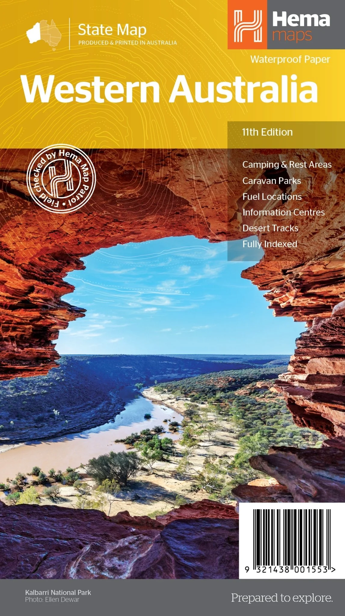
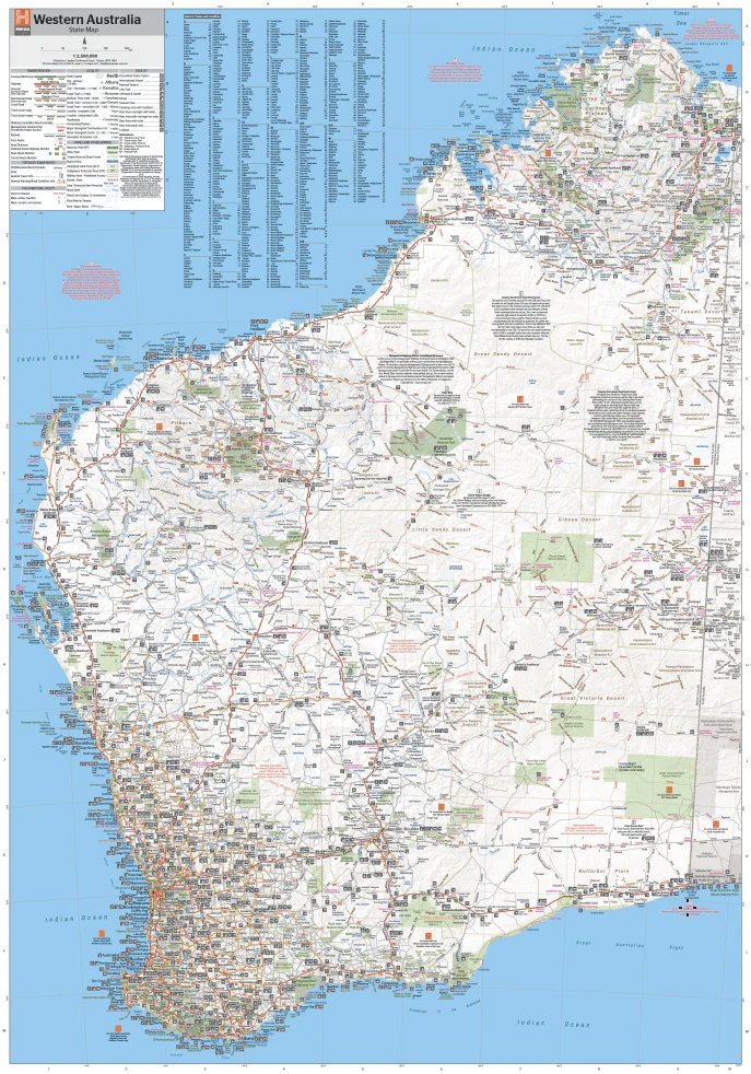
Western Australia State Map
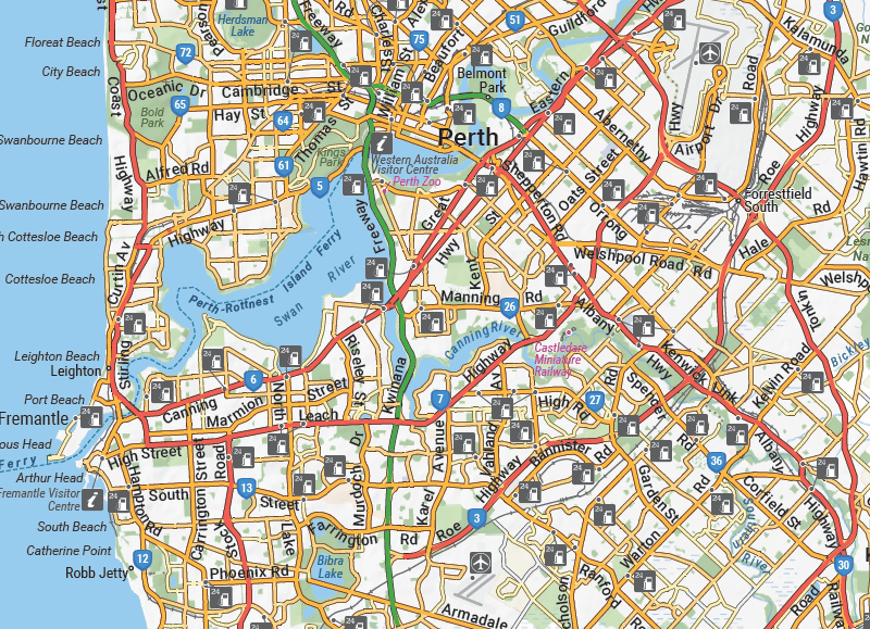
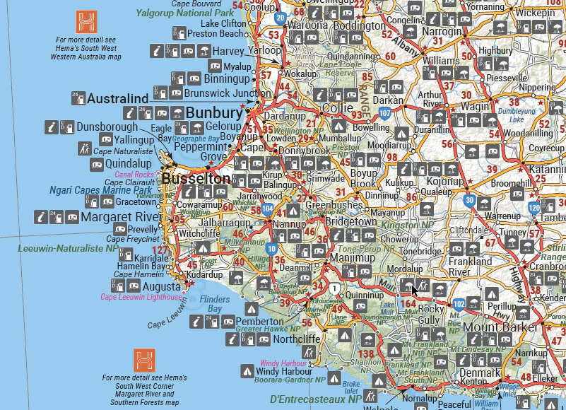
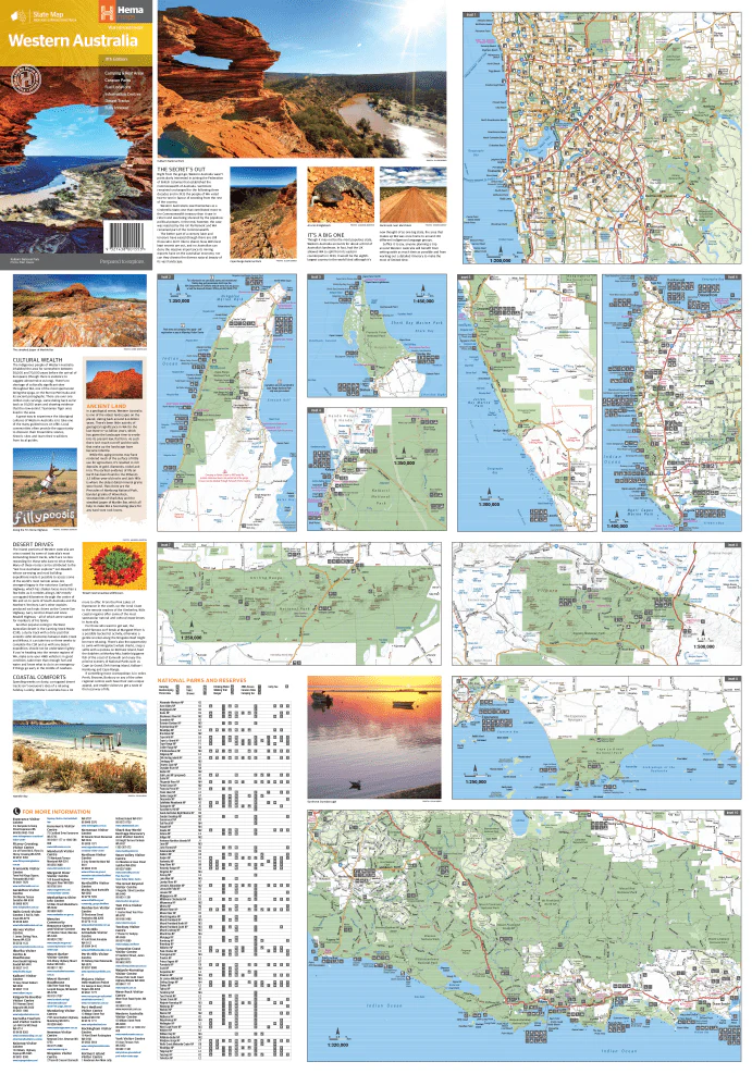
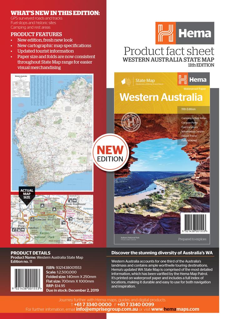
Hema's updated WA State Map is comprised of the most detailed information, which has been verified by Hema Map Patrol. It is printed on waterproof paper and includes a full index of locations, making it durable and easy to use for both navigation and inspiration. On the reverse side of the maps are through road maps of Perth, plus inset maps of Leeuwin-Naturaliste National Park, Cape Range National Park, Nambung National Park, Francois Peron National Park, Purnululu National Park, Walpole-Nornalup National Park and Karijini National Park. Also included are information centres within Western Australia.
Key Features
- Camping and rest areas
- Caravan parks
- Fuel locations
- Information centres
- Desert tracks
- Full index
Key Specifications
Edition: 11th
Publication Date: 01/11/19
Scale: 1:2,500,000
Folded size (WxHxD): 140mm x 250mm x 3mm
Flat size (WxH): 700mm x 1000mm
Weight: 0.09kgs
Original: $11.50
-65%$11.50
$4.02More Images
Western Australia State Map
Hema's updated WA State Map is comprised of the most detailed information, which has been verified by Hema Map Patrol. It is printed on waterproof paper and includes a full index of locations, making it durable and easy to use for both navigation and inspiration. On the reverse side of the maps are through road maps of Perth, plus inset maps of Leeuwin-Naturaliste National Park, Cape Range National Park, Nambung National Park, Francois Peron National Park, Purnululu National Park, Walpole-Nornalup National Park and Karijini National Park. Also included are information centres within Western Australia.
Key Features
- Camping and rest areas
- Caravan parks
- Fuel locations
- Information centres
- Desert tracks
- Full index
Key Specifications
Edition: 11th
Publication Date: 01/11/19
Scale: 1:2,500,000
Folded size (WxHxD): 140mm x 250mm x 3mm
Flat size (WxH): 700mm x 1000mm
Weight: 0.09kgs
Product Information
Product Information
Shipping & Returns
Shipping & Returns
Description
Hema's updated WA State Map is comprised of the most detailed information, which has been verified by Hema Map Patrol. It is printed on waterproof paper and includes a full index of locations, making it durable and easy to use for both navigation and inspiration. On the reverse side of the maps are through road maps of Perth, plus inset maps of Leeuwin-Naturaliste National Park, Cape Range National Park, Nambung National Park, Francois Peron National Park, Purnululu National Park, Walpole-Nornalup National Park and Karijini National Park. Also included are information centres within Western Australia.
Key Features
- Camping and rest areas
- Caravan parks
- Fuel locations
- Information centres
- Desert tracks
- Full index
Key Specifications
Edition: 11th
Publication Date: 01/11/19
Scale: 1:2,500,000
Folded size (WxHxD): 140mm x 250mm x 3mm
Flat size (WxH): 700mm x 1000mm
Weight: 0.09kgs


