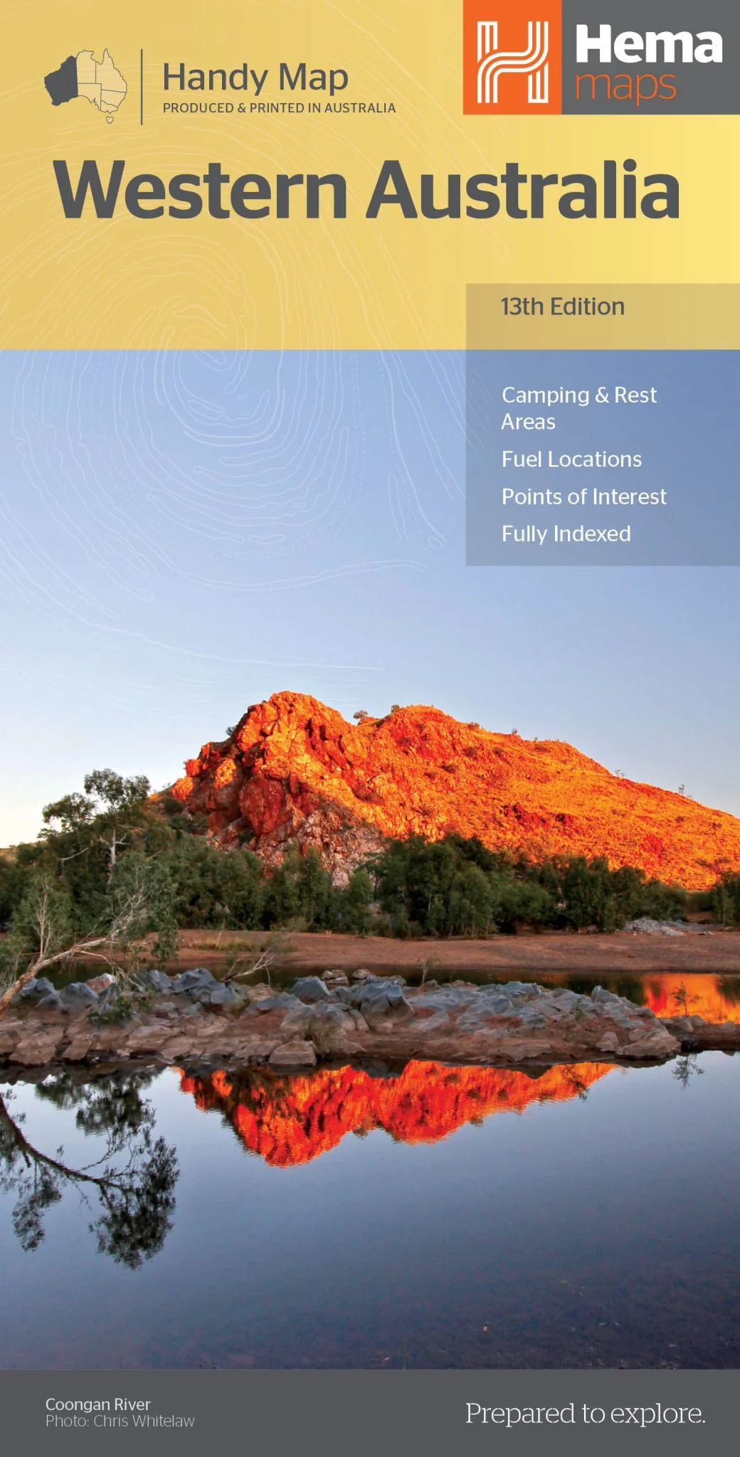
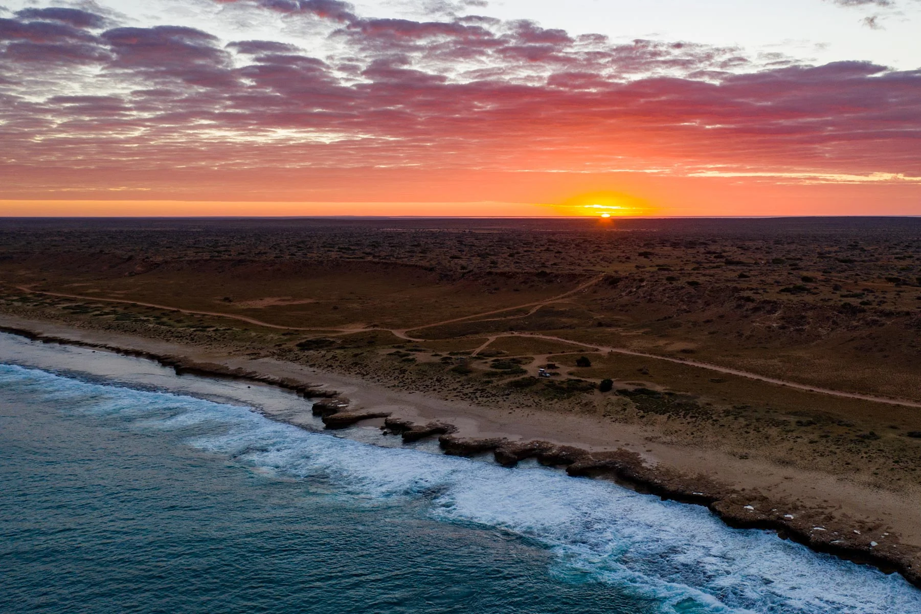
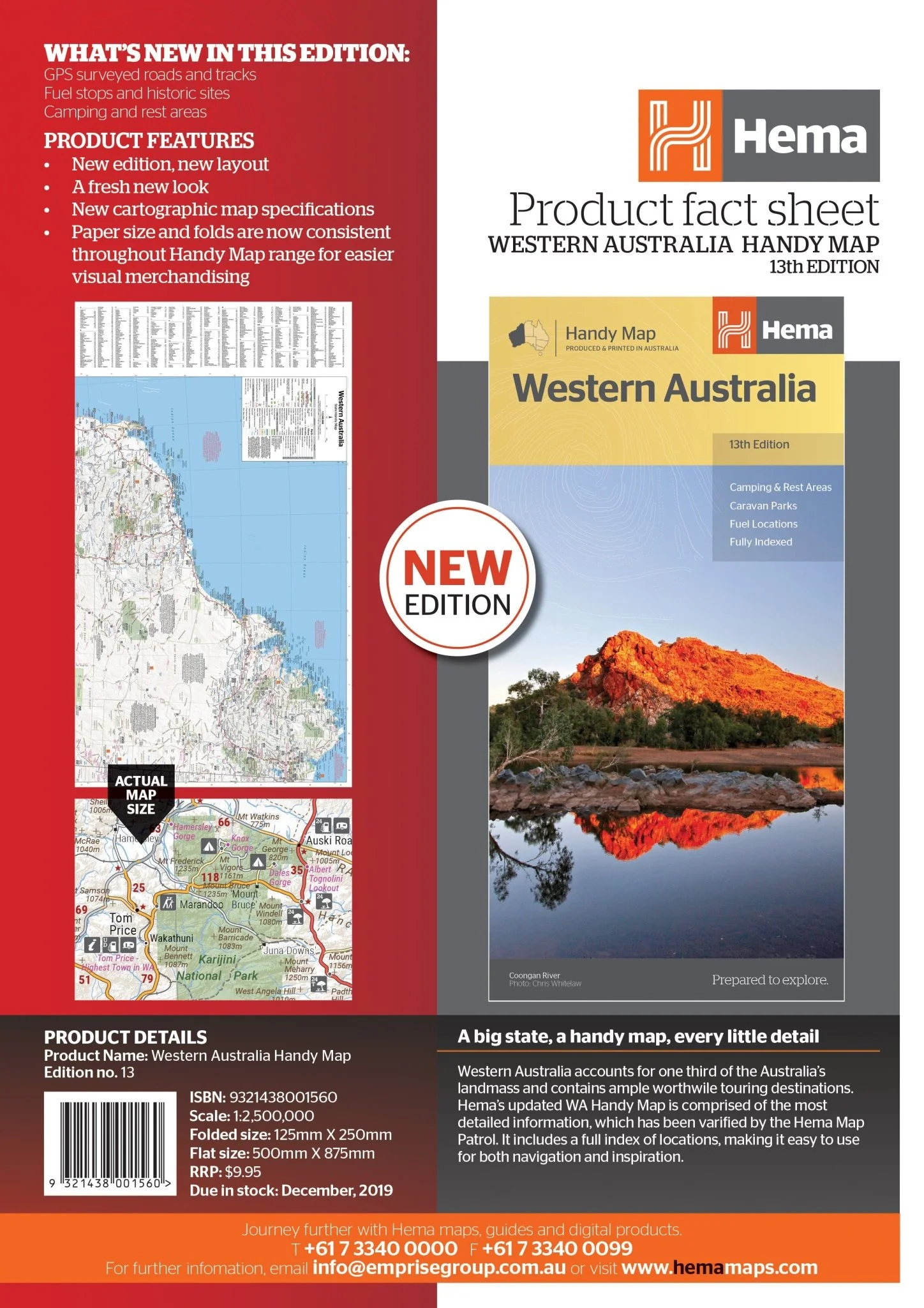
Western Australia Handy Map
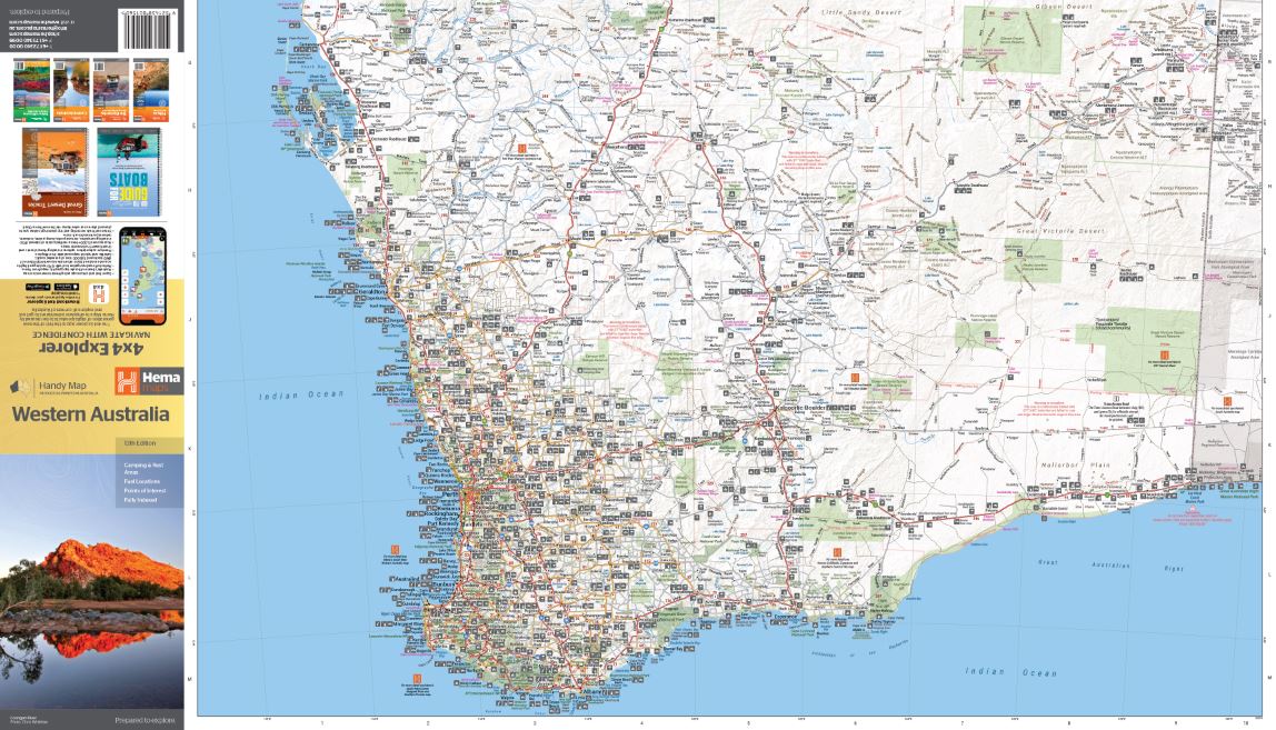
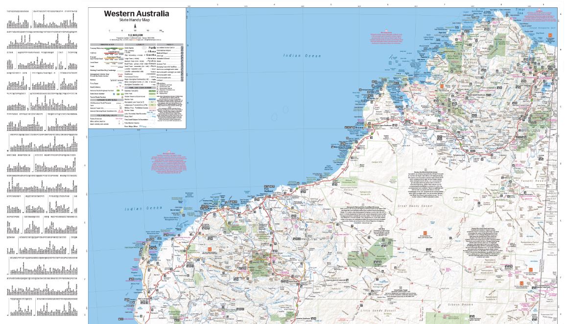
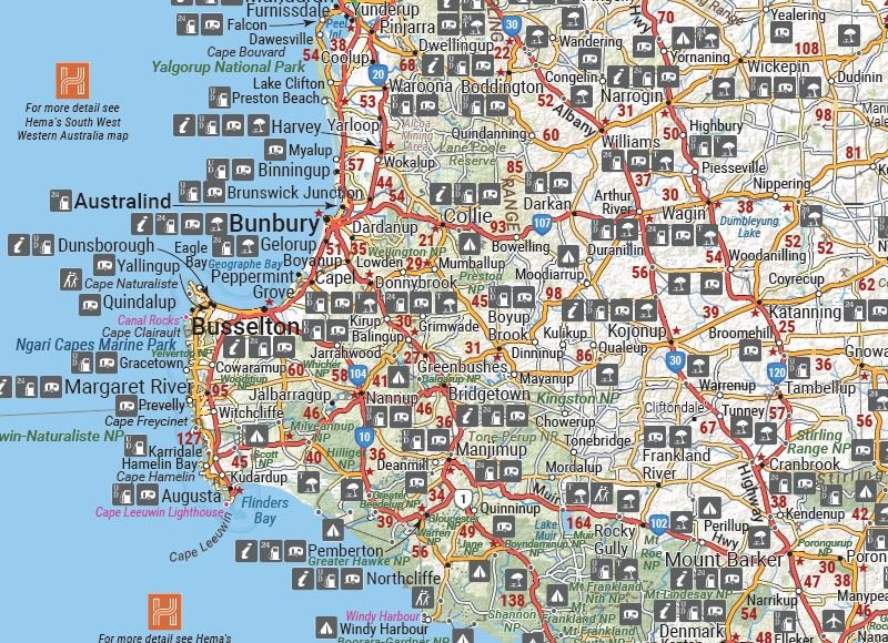
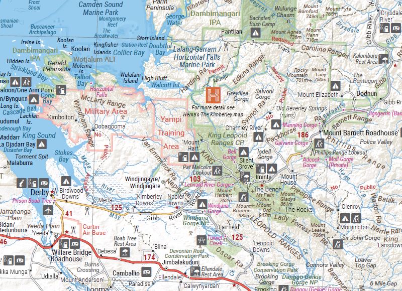
Hema's updated WA State Map is comprised of the most detailed information, which has been verified by Hema Map Patrol. It is printed on waterproof paper and includes a full index of locations, making it durable and easy to use for both navigation and inspiration. A compact map of Western Australia for touring throughout the state with a distance grid and index for reference. Marked on the mapping are highways, major and minor roads, camping and rest areas, 24-hour fuel, information centres, picnic areas, caravan parks and lookouts.
Key Features
• Camping areas
• Caravan Parks
• Fully indexed
• Easy to use
Key Specifications
Edition: 13th
Publication Date: 05/02/20
Scale: 1:2,500,000
Folded size (WxHxD): 125mm X 250mm x 3mm
Flat size (WxH): 500mm X 875mm
Weight: 0.09kgs
Original: $8.61
-65%$8.61
$3.01More Images
Western Australia Handy Map
Hema's updated WA State Map is comprised of the most detailed information, which has been verified by Hema Map Patrol. It is printed on waterproof paper and includes a full index of locations, making it durable and easy to use for both navigation and inspiration. A compact map of Western Australia for touring throughout the state with a distance grid and index for reference. Marked on the mapping are highways, major and minor roads, camping and rest areas, 24-hour fuel, information centres, picnic areas, caravan parks and lookouts.
Key Features
• Camping areas
• Caravan Parks
• Fully indexed
• Easy to use
Key Specifications
Edition: 13th
Publication Date: 05/02/20
Scale: 1:2,500,000
Folded size (WxHxD): 125mm X 250mm x 3mm
Flat size (WxH): 500mm X 875mm
Weight: 0.09kgs
Product Information
Product Information
Shipping & Returns
Shipping & Returns
Description
Hema's updated WA State Map is comprised of the most detailed information, which has been verified by Hema Map Patrol. It is printed on waterproof paper and includes a full index of locations, making it durable and easy to use for both navigation and inspiration. A compact map of Western Australia for touring throughout the state with a distance grid and index for reference. Marked on the mapping are highways, major and minor roads, camping and rest areas, 24-hour fuel, information centres, picnic areas, caravan parks and lookouts.
Key Features
• Camping areas
• Caravan Parks
• Fully indexed
• Easy to use
Key Specifications
Edition: 13th
Publication Date: 05/02/20
Scale: 1:2,500,000
Folded size (WxHxD): 125mm X 250mm x 3mm
Flat size (WxH): 500mm X 875mm
Weight: 0.09kgs


