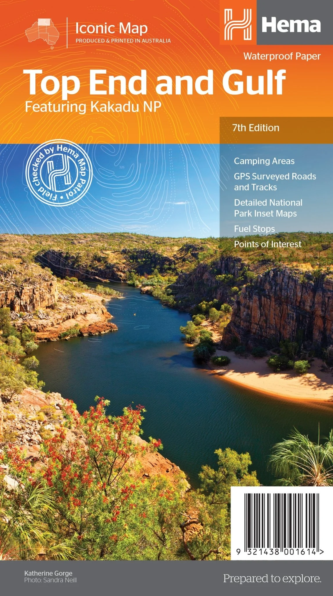
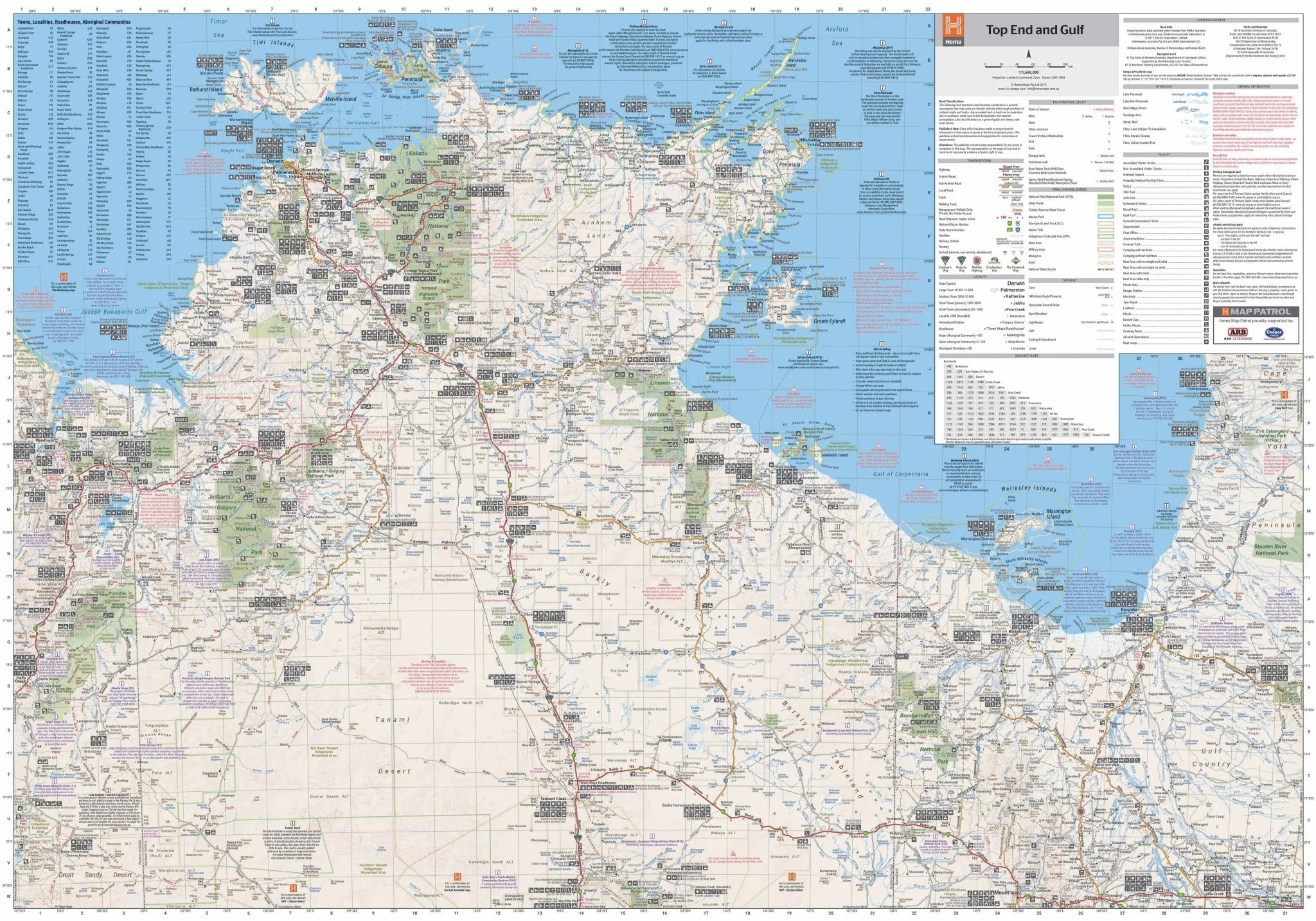
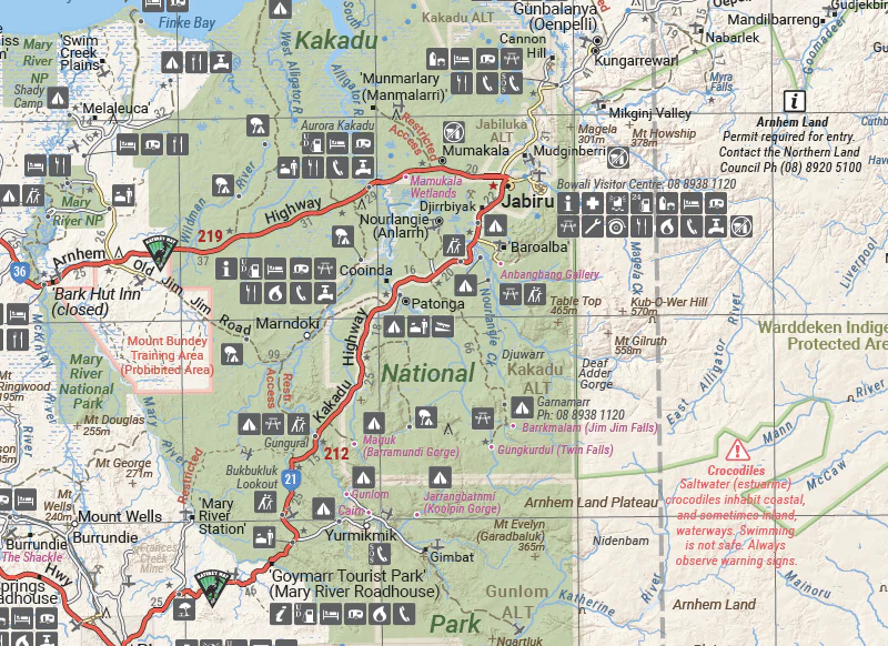
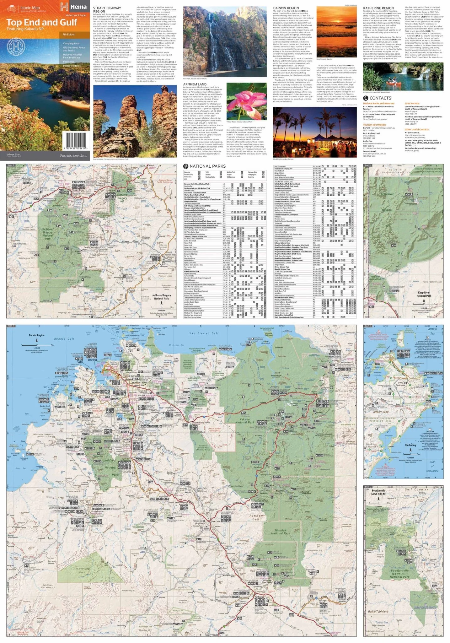
Top End and Gulf Map
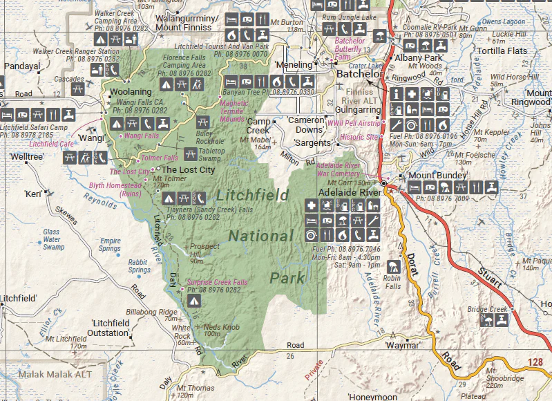
This regional waterproof map of the Top End and Gulf is ideal for discovering the northern parts of Australia's NT by 4WD. It includes a main map of the Darwin region, Judbarra / Gregory National Park, Nhulunbuy, Keep River National Park and Boodjamulla (Lawn Hill) National Park.
There is additional tourist information for Arnhem Land, the Roper River trek, Darwin region, Douglas-Daly district, Nature’s Way, Victoria Highway, Katherine Region and the Stuart Highway Region.
Key Features
- GPS surveyed roads and tracks
- Fuel stops
- Self-drive 4WD tracks
- Camping areas
- Historic sites
- Detailed National Park inset maps
- Waterproof paper
Key Specifications
Edition: 7th
Publication Date: 01/07/19
Scale: 1:1,650,000
Folded size (WxHxD): 140mm x 250mm x 3mm
Flat size (WxH): 700mm x 1000mm
Weight: 0.09kgs
More Images
Top End and Gulf Map
This regional waterproof map of the Top End and Gulf is ideal for discovering the northern parts of Australia's NT by 4WD. It includes a main map of the Darwin region, Judbarra / Gregory National Park, Nhulunbuy, Keep River National Park and Boodjamulla (Lawn Hill) National Park.
There is additional tourist information for Arnhem Land, the Roper River trek, Darwin region, Douglas-Daly district, Nature’s Way, Victoria Highway, Katherine Region and the Stuart Highway Region.
Key Features
- GPS surveyed roads and tracks
- Fuel stops
- Self-drive 4WD tracks
- Camping areas
- Historic sites
- Detailed National Park inset maps
- Waterproof paper
Key Specifications
Edition: 7th
Publication Date: 01/07/19
Scale: 1:1,650,000
Folded size (WxHxD): 140mm x 250mm x 3mm
Flat size (WxH): 700mm x 1000mm
Weight: 0.09kgs
Product Information
Product Information
Shipping & Returns
Shipping & Returns
Description
This regional waterproof map of the Top End and Gulf is ideal for discovering the northern parts of Australia's NT by 4WD. It includes a main map of the Darwin region, Judbarra / Gregory National Park, Nhulunbuy, Keep River National Park and Boodjamulla (Lawn Hill) National Park.
There is additional tourist information for Arnhem Land, the Roper River trek, Darwin region, Douglas-Daly district, Nature’s Way, Victoria Highway, Katherine Region and the Stuart Highway Region.
Key Features
- GPS surveyed roads and tracks
- Fuel stops
- Self-drive 4WD tracks
- Camping areas
- Historic sites
- Detailed National Park inset maps
- Waterproof paper
Key Specifications
Edition: 7th
Publication Date: 01/07/19
Scale: 1:1,650,000
Folded size (WxHxD): 140mm x 250mm x 3mm
Flat size (WxH): 700mm x 1000mm
Weight: 0.09kgs


