The Victorian High Country - Western Supermap - 1000x1430 - Laminated
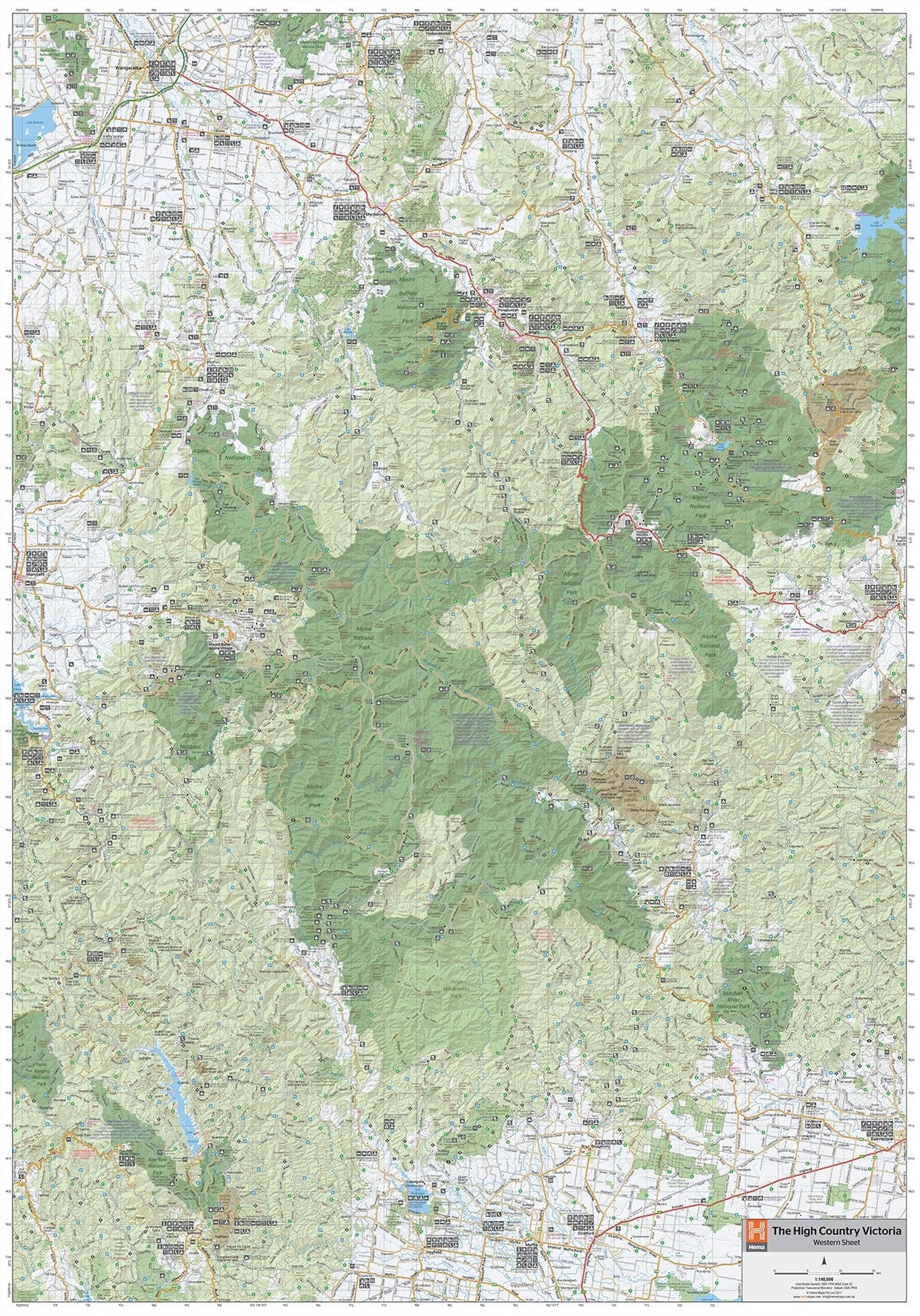
A large laminated map that features updated mapping of the Western region of the Victorian High Country. Spanning from Mansfield in the West to Omea in the East, from Wangaratta down to Walhalla in the South, this map covers an amazing area of natural beauty and historical significance. Featuring the Mount Buffallo, Alpine, Mitchell River, Baw Baw and Yarra Ranges National Parks as well Victoria's key alpine reports of Mt Buller & Falls Creek.
Key Features
- Fully field checked by Hema's Map Patrol
- Featuring the Alpine, Snowy River and Kosciuszko National Parks
- Includes historic towns of Licola, Dargo and Walhalla
- 4WD tracks marked
- Relief shading
- Iconic huts marked
- Points of Interest and facilities listed
Key Specifications
Edition: 1st
Publication Date: 03/06/20
Scale: 1:140,000
Flat size (WxH): 1000mm x 1430mm
Weight: 0.45kgs
The Victorian High Country - Western Supermap - 1000x1430 - Laminated
A large laminated map that features updated mapping of the Western region of the Victorian High Country. Spanning from Mansfield in the West to Omea in the East, from Wangaratta down to Walhalla in the South, this map covers an amazing area of natural beauty and historical significance. Featuring the Mount Buffallo, Alpine, Mitchell River, Baw Baw and Yarra Ranges National Parks as well Victoria's key alpine reports of Mt Buller & Falls Creek.
Key Features
- Fully field checked by Hema's Map Patrol
- Featuring the Alpine, Snowy River and Kosciuszko National Parks
- Includes historic towns of Licola, Dargo and Walhalla
- 4WD tracks marked
- Relief shading
- Iconic huts marked
- Points of Interest and facilities listed
Key Specifications
Edition: 1st
Publication Date: 03/06/20
Scale: 1:140,000
Flat size (WxH): 1000mm x 1430mm
Weight: 0.45kgs
Product Information
Product Information
Shipping & Returns
Shipping & Returns
Description
A large laminated map that features updated mapping of the Western region of the Victorian High Country. Spanning from Mansfield in the West to Omea in the East, from Wangaratta down to Walhalla in the South, this map covers an amazing area of natural beauty and historical significance. Featuring the Mount Buffallo, Alpine, Mitchell River, Baw Baw and Yarra Ranges National Parks as well Victoria's key alpine reports of Mt Buller & Falls Creek.
Key Features
- Fully field checked by Hema's Map Patrol
- Featuring the Alpine, Snowy River and Kosciuszko National Parks
- Includes historic towns of Licola, Dargo and Walhalla
- 4WD tracks marked
- Relief shading
- Iconic huts marked
- Points of Interest and facilities listed
Key Specifications
Edition: 1st
Publication Date: 03/06/20
Scale: 1:140,000
Flat size (WxH): 1000mm x 1430mm
Weight: 0.45kgs


