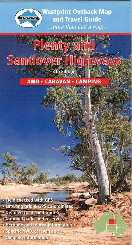
The Plenty and Sandover Highways Map
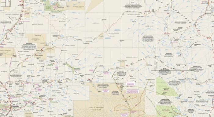
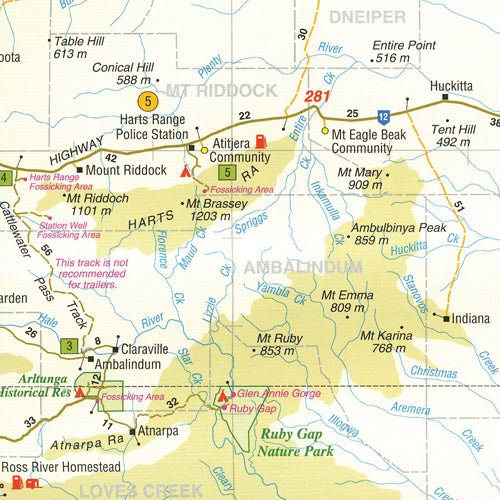
This Westprint Heritage Map features a map of Plenty Highway and part of Sandover Highway on one side with the remainder of the Sandover Highway on the reverse side plus all sorts of great information.
The Diamantina Developmental Road between Birdsville and Dajarra is also included.
A feature of all Westprint maps is the amount of text of historic and tourist interest. The map contains numbered symbols cross-referenced to detailed information on each numbered site. Intermediate and major distances are clearly shown and there are symbols for fuel locations, rest areas, caravan parks and camp sites. Early explorers routes have been colour-coded. There are also GPS co-ordinates.
This map covers: Plenty Highway, Sandover Highway (part of), Diamantina Developmental Road, Birdsville and Dajarra.
Key Features
- Detailed 4WD tracks
- National parks
- Specific 4WD, caravan and camping information
- GPS surveyed roads & tracks
- Heritage & tourist information
Key Specifications
Edition: 4th
Publication Date: 01/01/13
Folded size (WxHxD): 140mm x 250mm x 2mm
Flat size (WxH): 700mm x 1000mm
Weight: 0.09kgs
Original: $10.78
-65%$10.78
$3.77More Images
The Plenty and Sandover Highways Map
This Westprint Heritage Map features a map of Plenty Highway and part of Sandover Highway on one side with the remainder of the Sandover Highway on the reverse side plus all sorts of great information.
The Diamantina Developmental Road between Birdsville and Dajarra is also included.
A feature of all Westprint maps is the amount of text of historic and tourist interest. The map contains numbered symbols cross-referenced to detailed information on each numbered site. Intermediate and major distances are clearly shown and there are symbols for fuel locations, rest areas, caravan parks and camp sites. Early explorers routes have been colour-coded. There are also GPS co-ordinates.
This map covers: Plenty Highway, Sandover Highway (part of), Diamantina Developmental Road, Birdsville and Dajarra.
Key Features
- Detailed 4WD tracks
- National parks
- Specific 4WD, caravan and camping information
- GPS surveyed roads & tracks
- Heritage & tourist information
Key Specifications
Edition: 4th
Publication Date: 01/01/13
Folded size (WxHxD): 140mm x 250mm x 2mm
Flat size (WxH): 700mm x 1000mm
Weight: 0.09kgs
Product Information
Product Information
Shipping & Returns
Shipping & Returns
Description
This Westprint Heritage Map features a map of Plenty Highway and part of Sandover Highway on one side with the remainder of the Sandover Highway on the reverse side plus all sorts of great information.
The Diamantina Developmental Road between Birdsville and Dajarra is also included.
A feature of all Westprint maps is the amount of text of historic and tourist interest. The map contains numbered symbols cross-referenced to detailed information on each numbered site. Intermediate and major distances are clearly shown and there are symbols for fuel locations, rest areas, caravan parks and camp sites. Early explorers routes have been colour-coded. There are also GPS co-ordinates.
This map covers: Plenty Highway, Sandover Highway (part of), Diamantina Developmental Road, Birdsville and Dajarra.
Key Features
- Detailed 4WD tracks
- National parks
- Specific 4WD, caravan and camping information
- GPS surveyed roads & tracks
- Heritage & tourist information
Key Specifications
Edition: 4th
Publication Date: 01/01/13
Folded size (WxHxD): 140mm x 250mm x 2mm
Flat size (WxH): 700mm x 1000mm
Weight: 0.09kgs


