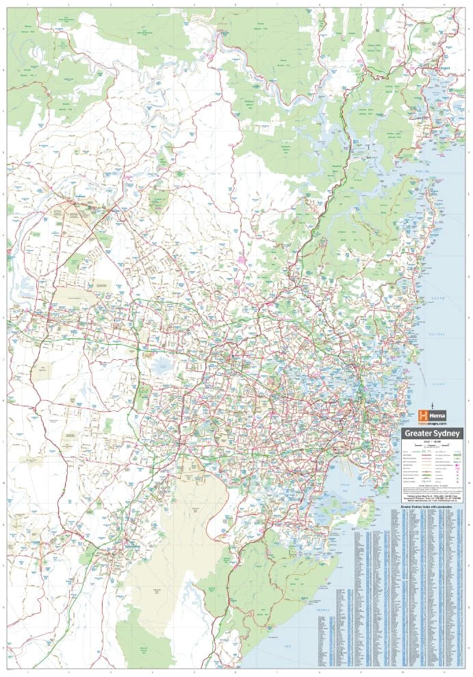
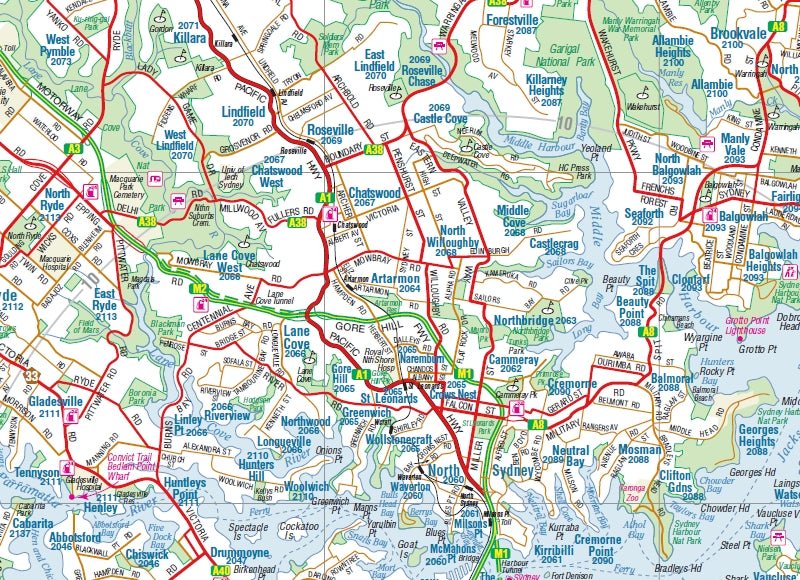
Sydney and Region Wall Map
A comprehensive and detailed laminated large map of Sydney and surrounds. The mapping features suburbs and postcodes, marked camping areas, caravan parks, fuel supplies, major national parks and an index. The map covers from Stanwell Park in the south to Penrith in the west and past Gosford in the north.
Available in two finishes and two sizes as follows:
Finish
- Laminated encapsulated - high quality produced by Hema Maps
- Photo paper; Satin 255gsm (unlaminated) - high quality produced by Hema Maps
Size
- Large Map (WxH) - 700 x 1000mm (scale:1:80,000)
- Super Map (WxH) - 1000 x 1430mm (scale: 1:56,000)
All maps are designed and printed in Australia.
Key Features
- Easy-to-read cartography
- Sydney Harbour
- Wall map
- Index
- Postcodes
Key Specifications
Edition: 9th
Publication Date: 01/12/2014
Want something different. We do custom maps. Email: [email protected]
Original: $68.45
-65%$68.45
$23.96More Images
Sydney and Region Wall Map
A comprehensive and detailed laminated large map of Sydney and surrounds. The mapping features suburbs and postcodes, marked camping areas, caravan parks, fuel supplies, major national parks and an index. The map covers from Stanwell Park in the south to Penrith in the west and past Gosford in the north.
Available in two finishes and two sizes as follows:
Finish
- Laminated encapsulated - high quality produced by Hema Maps
- Photo paper; Satin 255gsm (unlaminated) - high quality produced by Hema Maps
Size
- Large Map (WxH) - 700 x 1000mm (scale:1:80,000)
- Super Map (WxH) - 1000 x 1430mm (scale: 1:56,000)
All maps are designed and printed in Australia.
Key Features
- Easy-to-read cartography
- Sydney Harbour
- Wall map
- Index
- Postcodes
Key Specifications
Edition: 9th
Publication Date: 01/12/2014
Want something different. We do custom maps. Email: [email protected]
Product Information
Product Information
Shipping & Returns
Shipping & Returns
Description
A comprehensive and detailed laminated large map of Sydney and surrounds. The mapping features suburbs and postcodes, marked camping areas, caravan parks, fuel supplies, major national parks and an index. The map covers from Stanwell Park in the south to Penrith in the west and past Gosford in the north.
Available in two finishes and two sizes as follows:
Finish
- Laminated encapsulated - high quality produced by Hema Maps
- Photo paper; Satin 255gsm (unlaminated) - high quality produced by Hema Maps
Size
- Large Map (WxH) - 700 x 1000mm (scale:1:80,000)
- Super Map (WxH) - 1000 x 1430mm (scale: 1:56,000)
All maps are designed and printed in Australia.
Key Features
- Easy-to-read cartography
- Sydney Harbour
- Wall map
- Index
- Postcodes
Key Specifications
Edition: 9th
Publication Date: 01/12/2014
Want something different. We do custom maps. Email: [email protected]


