North Queensland Map
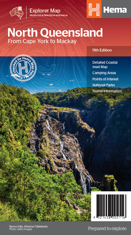
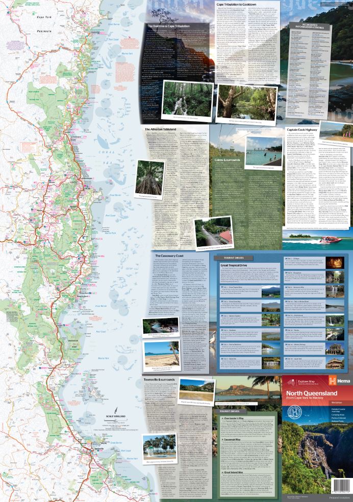
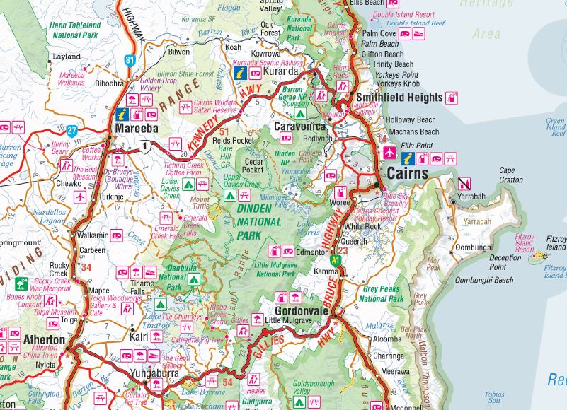
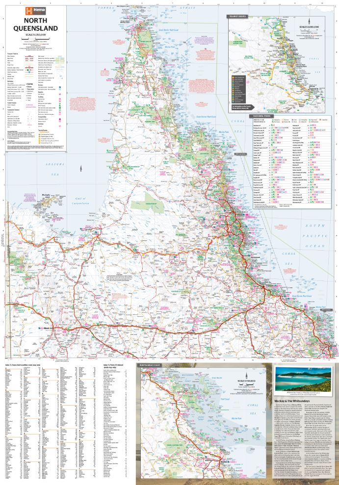
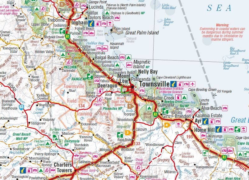
This is the ideal North Queensland map for discovering the many destinations between Mackay and The Tip. The mapping is at a touring scale of 1:750,000, with terrain shading and touring symbols giving an accurate and informative overview of the region. There is a detailed inset map for Mackay and the Whitsundays and another for the entire coastal strip between Townsville and Cooktown. There is also tourist information on the popular coastal strip with a handy list of national park facilities and information centres as well.
Key Features
- Detailed coastal inset map
- Camping areas
- Points of Interest
- National Parks
- Tourist areas
Key Specifications
Edition: 11th
Publication Date: 01/12/13
Scale: 1:1,750,000
Folded size (WxHxD): 140mm x 250mm x 3mm
Flat size (WxH): 700mm x 1000mm
Weight: 0.09kgs
Original: $11.50
-65%$11.50
$4.02More Images
North Queensland Map
This is the ideal North Queensland map for discovering the many destinations between Mackay and The Tip. The mapping is at a touring scale of 1:750,000, with terrain shading and touring symbols giving an accurate and informative overview of the region. There is a detailed inset map for Mackay and the Whitsundays and another for the entire coastal strip between Townsville and Cooktown. There is also tourist information on the popular coastal strip with a handy list of national park facilities and information centres as well.
Key Features
- Detailed coastal inset map
- Camping areas
- Points of Interest
- National Parks
- Tourist areas
Key Specifications
Edition: 11th
Publication Date: 01/12/13
Scale: 1:1,750,000
Folded size (WxHxD): 140mm x 250mm x 3mm
Flat size (WxH): 700mm x 1000mm
Weight: 0.09kgs
Product Information
Product Information
Shipping & Returns
Shipping & Returns
Description
This is the ideal North Queensland map for discovering the many destinations between Mackay and The Tip. The mapping is at a touring scale of 1:750,000, with terrain shading and touring symbols giving an accurate and informative overview of the region. There is a detailed inset map for Mackay and the Whitsundays and another for the entire coastal strip between Townsville and Cooktown. There is also tourist information on the popular coastal strip with a handy list of national park facilities and information centres as well.
Key Features
- Detailed coastal inset map
- Camping areas
- Points of Interest
- National Parks
- Tourist areas
Key Specifications
Edition: 11th
Publication Date: 01/12/13
Scale: 1:1,750,000
Folded size (WxHxD): 140mm x 250mm x 3mm
Flat size (WxH): 700mm x 1000mm
Weight: 0.09kgs


