Mallacoota - Merimbula Adventure Map
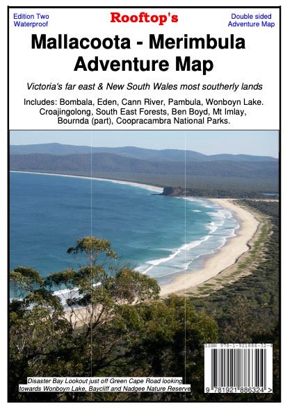
Mallacoota Merimbula Adventure Map is a 1:100,000 scale map. Covering Victoria’s far east and New South Wales far south-east includes Bomballa, Eden, Cann River, Pambula, Wonboyn Lake, Ben Boyd, Croajingolong, South East Forests, Mt Imlay, Alfred and Coopracambra National Parks, Tomboon Inlet and Wingan Inlet.
The rear shows continued coverage of the front side and includes inserts of South East Forest National Park Proposed public access – Eastern Section at 1:200,000 scale with no contours, and Mallacoota Inlet Fishing and Boat Access Map at 1:40,000 scale with 25m contours, and Gabo Island Map at a scale of 1:40,000.
Information includes walking tracks, vehicle tracks, roads, estuaries, watercourses, places of interest, navigation markers, boat ramps, jetties etc.
Key Specifications
Edition: 2nd
Publication Date: 01/11/22
Scale: 1:100,000
Folded size (WxHxD): 129mm x 210mm x 3mm
Flat size (WxH): 630mm x 900mm
Weight: 0.074kgs
Original: $11.50
-65%$11.50
$4.02Mallacoota - Merimbula Adventure Map
Mallacoota Merimbula Adventure Map is a 1:100,000 scale map. Covering Victoria’s far east and New South Wales far south-east includes Bomballa, Eden, Cann River, Pambula, Wonboyn Lake, Ben Boyd, Croajingolong, South East Forests, Mt Imlay, Alfred and Coopracambra National Parks, Tomboon Inlet and Wingan Inlet.
The rear shows continued coverage of the front side and includes inserts of South East Forest National Park Proposed public access – Eastern Section at 1:200,000 scale with no contours, and Mallacoota Inlet Fishing and Boat Access Map at 1:40,000 scale with 25m contours, and Gabo Island Map at a scale of 1:40,000.
Information includes walking tracks, vehicle tracks, roads, estuaries, watercourses, places of interest, navigation markers, boat ramps, jetties etc.
Key Specifications
Edition: 2nd
Publication Date: 01/11/22
Scale: 1:100,000
Folded size (WxHxD): 129mm x 210mm x 3mm
Flat size (WxH): 630mm x 900mm
Weight: 0.074kgs
Product Information
Product Information
Shipping & Returns
Shipping & Returns
Description
Mallacoota Merimbula Adventure Map is a 1:100,000 scale map. Covering Victoria’s far east and New South Wales far south-east includes Bomballa, Eden, Cann River, Pambula, Wonboyn Lake, Ben Boyd, Croajingolong, South East Forests, Mt Imlay, Alfred and Coopracambra National Parks, Tomboon Inlet and Wingan Inlet.
The rear shows continued coverage of the front side and includes inserts of South East Forest National Park Proposed public access – Eastern Section at 1:200,000 scale with no contours, and Mallacoota Inlet Fishing and Boat Access Map at 1:40,000 scale with 25m contours, and Gabo Island Map at a scale of 1:40,000.
Information includes walking tracks, vehicle tracks, roads, estuaries, watercourses, places of interest, navigation markers, boat ramps, jetties etc.
Key Specifications
Edition: 2nd
Publication Date: 01/11/22
Scale: 1:100,000
Folded size (WxHxD): 129mm x 210mm x 3mm
Flat size (WxH): 630mm x 900mm
Weight: 0.074kgs


