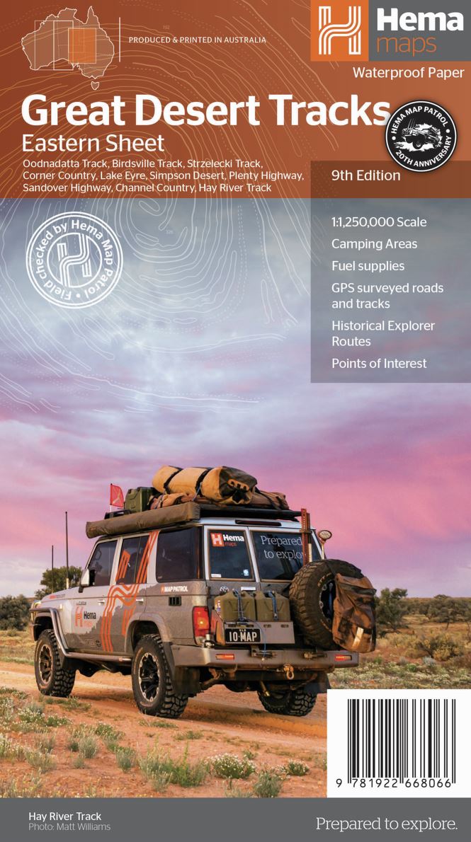
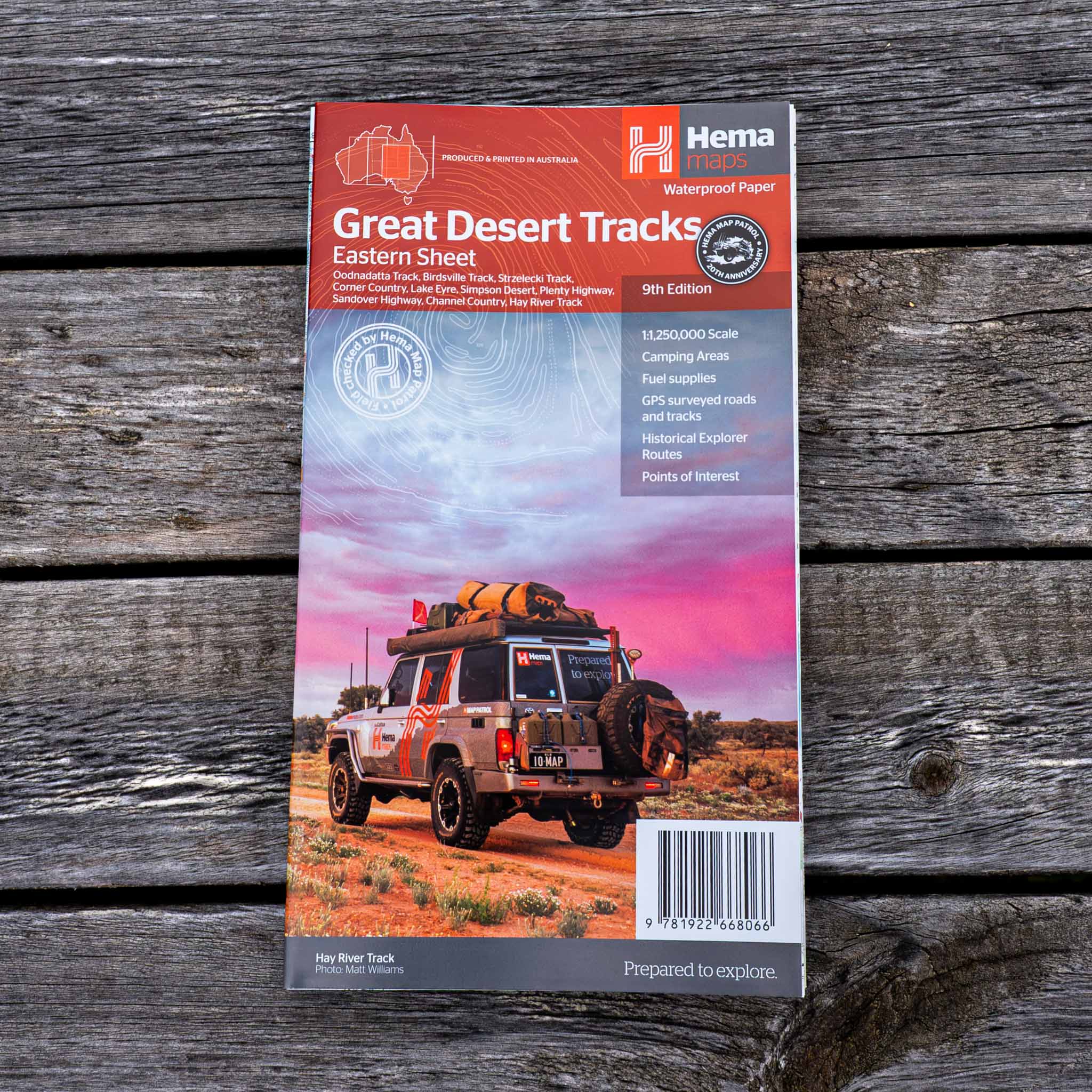
Great Desert Tracks Eastern Sheet
Hema's Great Desert Tracks maps are essential for anyone travelling in the Australian outback. The mapping features roads and 4WD tracks field-checked by the Hema Map Patrol, Points of Interest for remote area travellers and touring information for learning more about the region and planning your journey.
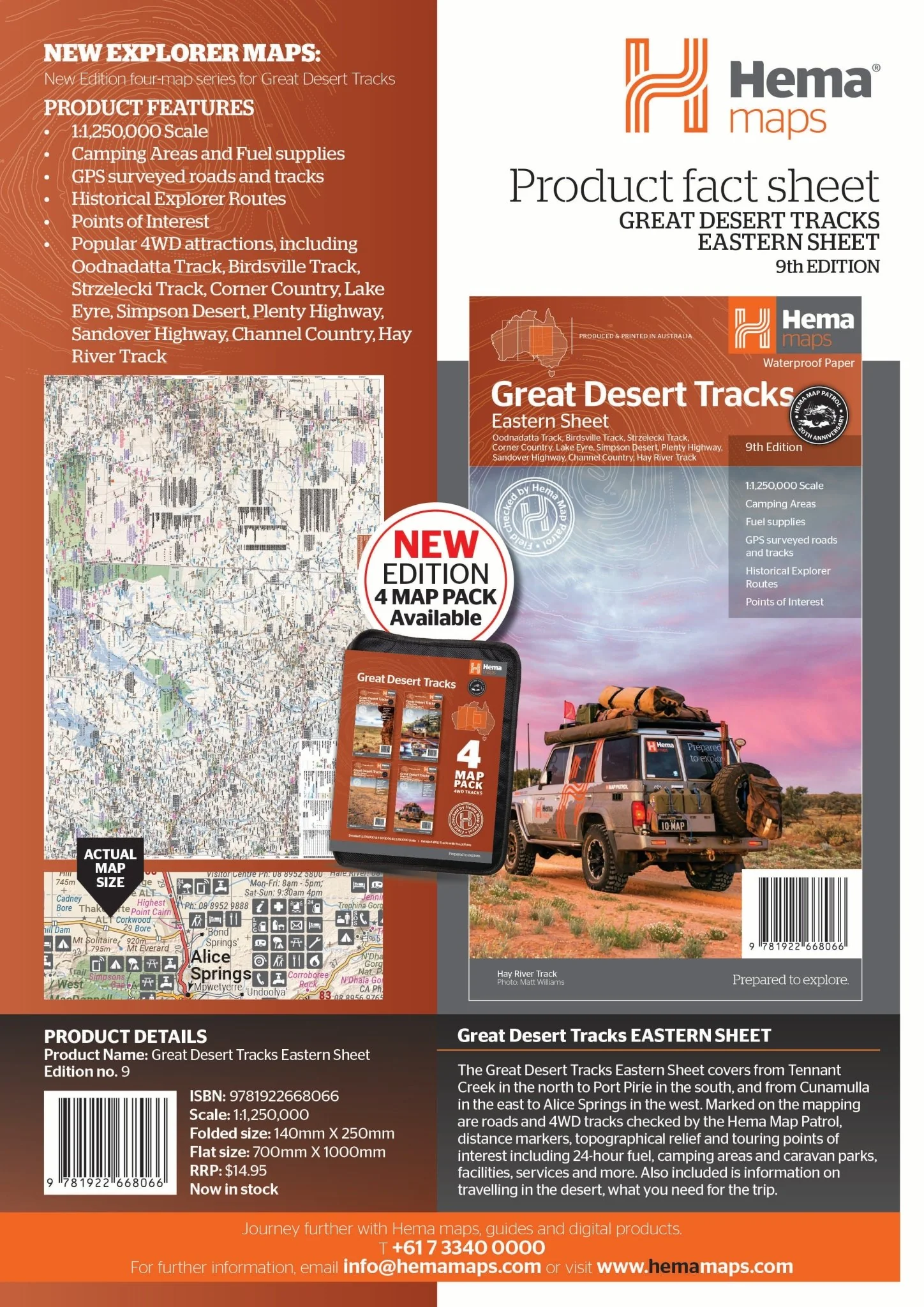
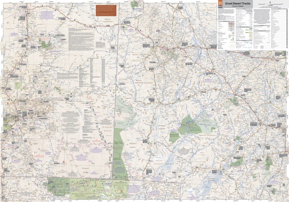
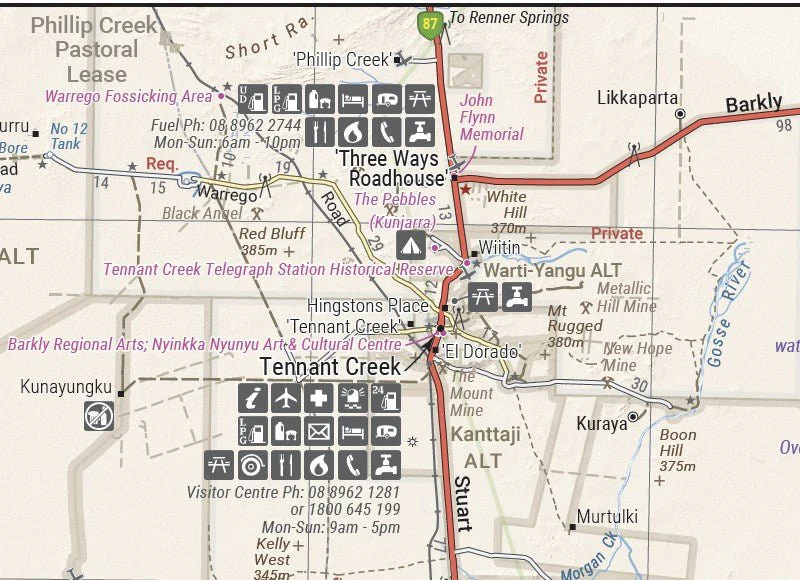
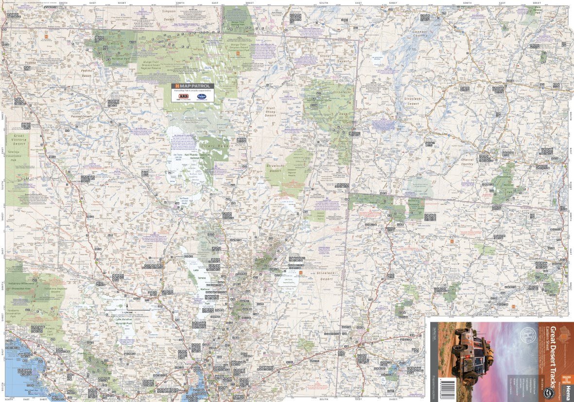
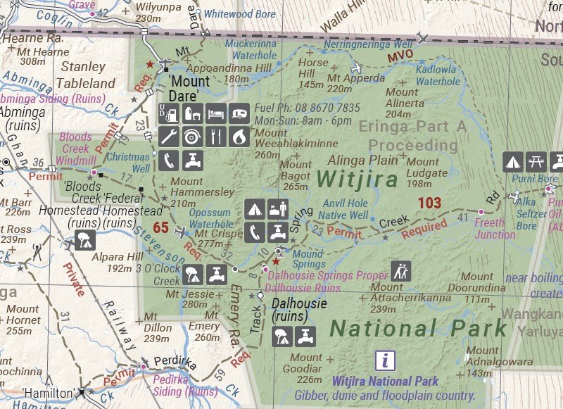
The Great Desert Tracks Eastern Sheet covers from Tennant Creek in the north to Port Pirie in the south, and from Cunamulla in the east to Alice Springs in the west. Marked on the mapping are roads and 4WD tracks checked by the Hema Map Patrol, distance markers, topographical relief and touring points of interest including 24-hour fuel, camping areas and caravan parks, facilities, services and more. Also included is information on travelling in the desert, what you need for the trip and relevant contact information.
Tracks covered include:
- Oodnadatta Track
- Birdsville Track
- Strzelecki Track
- Nullabor Plain
- Corner Country
- Lake Eyre
- Simpson Desert
- Plenty Highway
- Sandover Highway
- Channel Country
- Hay River Track
Key Features
- All maps field checked by the Hema Map Patrol
- Printed on durable, waterproof paper
- Camping areas
- Fuel Supplies
- GPS surveyed roads and tracks
- Historical explorer routes
- Points of Interest
Check out this video of the Hema Map Patrol's fieldwork in Central Australia to produce this product at this link
Key Specifications
Edition: 9th
Publication Date: 15/06/22
Scale: 1:1,250,000
Folded size (WxHxD): 140mm x 250mm x 6mm
Flat size (WxH): 700mm x 1000mm
Weight: 0.055kgs
More Images
Great Desert Tracks Eastern Sheet
Hema's Great Desert Tracks maps are essential for anyone travelling in the Australian outback. The mapping features roads and 4WD tracks field-checked by the Hema Map Patrol, Points of Interest for remote area travellers and touring information for learning more about the region and planning your journey.
The Great Desert Tracks Eastern Sheet covers from Tennant Creek in the north to Port Pirie in the south, and from Cunamulla in the east to Alice Springs in the west. Marked on the mapping are roads and 4WD tracks checked by the Hema Map Patrol, distance markers, topographical relief and touring points of interest including 24-hour fuel, camping areas and caravan parks, facilities, services and more. Also included is information on travelling in the desert, what you need for the trip and relevant contact information.
Tracks covered include:
- Oodnadatta Track
- Birdsville Track
- Strzelecki Track
- Nullabor Plain
- Corner Country
- Lake Eyre
- Simpson Desert
- Plenty Highway
- Sandover Highway
- Channel Country
- Hay River Track
Key Features
- All maps field checked by the Hema Map Patrol
- Printed on durable, waterproof paper
- Camping areas
- Fuel Supplies
- GPS surveyed roads and tracks
- Historical explorer routes
- Points of Interest
Check out this video of the Hema Map Patrol's fieldwork in Central Australia to produce this product at this link
Key Specifications
Edition: 9th
Publication Date: 15/06/22
Scale: 1:1,250,000
Folded size (WxHxD): 140mm x 250mm x 6mm
Flat size (WxH): 700mm x 1000mm
Weight: 0.055kgs
Product Information
Product Information
Shipping & Returns
Shipping & Returns
Description
Hema's Great Desert Tracks maps are essential for anyone travelling in the Australian outback. The mapping features roads and 4WD tracks field-checked by the Hema Map Patrol, Points of Interest for remote area travellers and touring information for learning more about the region and planning your journey.
The Great Desert Tracks Eastern Sheet covers from Tennant Creek in the north to Port Pirie in the south, and from Cunamulla in the east to Alice Springs in the west. Marked on the mapping are roads and 4WD tracks checked by the Hema Map Patrol, distance markers, topographical relief and touring points of interest including 24-hour fuel, camping areas and caravan parks, facilities, services and more. Also included is information on travelling in the desert, what you need for the trip and relevant contact information.
Tracks covered include:
- Oodnadatta Track
- Birdsville Track
- Strzelecki Track
- Nullabor Plain
- Corner Country
- Lake Eyre
- Simpson Desert
- Plenty Highway
- Sandover Highway
- Channel Country
- Hay River Track
Key Features
- All maps field checked by the Hema Map Patrol
- Printed on durable, waterproof paper
- Camping areas
- Fuel Supplies
- GPS surveyed roads and tracks
- Historical explorer routes
- Points of Interest
Check out this video of the Hema Map Patrol's fieldwork in Central Australia to produce this product at this link
Key Specifications
Edition: 9th
Publication Date: 15/06/22
Scale: 1:1,250,000
Folded size (WxHxD): 140mm x 250mm x 6mm
Flat size (WxH): 700mm x 1000mm
Weight: 0.055kgs


