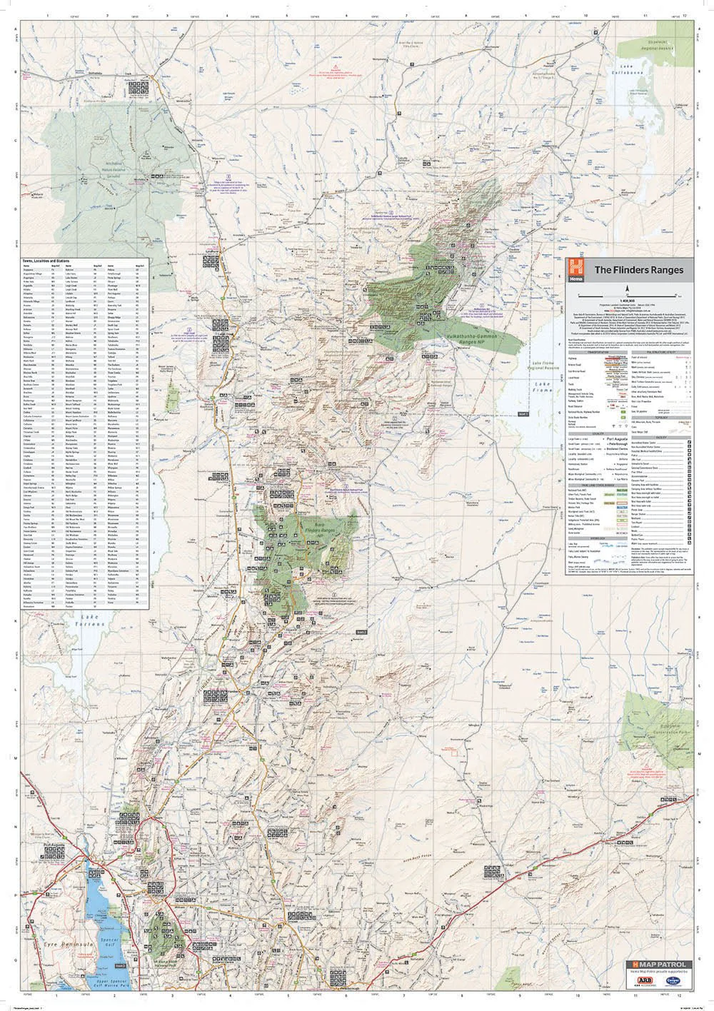
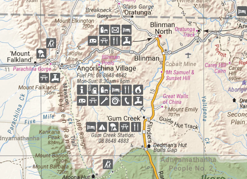
Flinders Ranges Wall Map
A large wall map that features mapping of the Flinders Ranges in 1:280,000 scale. Spanning from the Eyre Peninsula up to Lake Collabonna this incredibly detailed map of covers one of Australia's most iconic regions.
Available in two finishes at the Megamap - 1000x1430mm size.
Finish
- Laminated encapsulated - high quality produced by Hema Maps
- Photo paper; Satin 255gsm (unlaminated) - high quality produced by Hema Maps
All maps are designed and printed in Australia.
Key Features
- Fully field checked by Hema's Map Patrol
- Featuring the Vulkathuna-Gamon Ranges, Ikara-Flinders Ranges and Mt Remarkable National Parks
- 4WD tracks marked
- Relief shading
- Listing of Towns, Localities and Stations
- Points of Interest and facilities listed (including fuel stops and accommodation)
Key Specifications
Edition: 1st
Publication Date: 03/06/20
Scale: 1:280,000
Flat size (WxH): 1000mm x 1430mm
Weight: 0.45kgs
Want something different. We do custom maps. Email: [email protected]
Original: $90.08
-65%$90.08
$31.53More Images
Flinders Ranges Wall Map
A large wall map that features mapping of the Flinders Ranges in 1:280,000 scale. Spanning from the Eyre Peninsula up to Lake Collabonna this incredibly detailed map of covers one of Australia's most iconic regions.
Available in two finishes at the Megamap - 1000x1430mm size.
Finish
- Laminated encapsulated - high quality produced by Hema Maps
- Photo paper; Satin 255gsm (unlaminated) - high quality produced by Hema Maps
All maps are designed and printed in Australia.
Key Features
- Fully field checked by Hema's Map Patrol
- Featuring the Vulkathuna-Gamon Ranges, Ikara-Flinders Ranges and Mt Remarkable National Parks
- 4WD tracks marked
- Relief shading
- Listing of Towns, Localities and Stations
- Points of Interest and facilities listed (including fuel stops and accommodation)
Key Specifications
Edition: 1st
Publication Date: 03/06/20
Scale: 1:280,000
Flat size (WxH): 1000mm x 1430mm
Weight: 0.45kgs
Want something different. We do custom maps. Email: [email protected]
Product Information
Product Information
Shipping & Returns
Shipping & Returns
Description
A large wall map that features mapping of the Flinders Ranges in 1:280,000 scale. Spanning from the Eyre Peninsula up to Lake Collabonna this incredibly detailed map of covers one of Australia's most iconic regions.
Available in two finishes at the Megamap - 1000x1430mm size.
Finish
- Laminated encapsulated - high quality produced by Hema Maps
- Photo paper; Satin 255gsm (unlaminated) - high quality produced by Hema Maps
All maps are designed and printed in Australia.
Key Features
- Fully field checked by Hema's Map Patrol
- Featuring the Vulkathuna-Gamon Ranges, Ikara-Flinders Ranges and Mt Remarkable National Parks
- 4WD tracks marked
- Relief shading
- Listing of Towns, Localities and Stations
- Points of Interest and facilities listed (including fuel stops and accommodation)
Key Specifications
Edition: 1st
Publication Date: 03/06/20
Scale: 1:280,000
Flat size (WxH): 1000mm x 1430mm
Weight: 0.45kgs
Want something different. We do custom maps. Email: [email protected]


