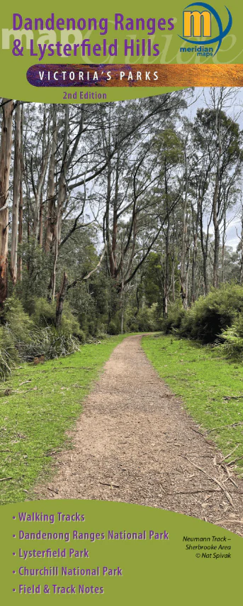
Dandenong Ranges & Lysterfield Hills Map Guide
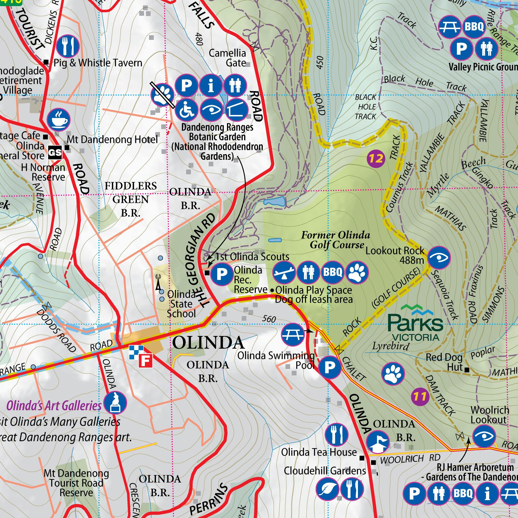
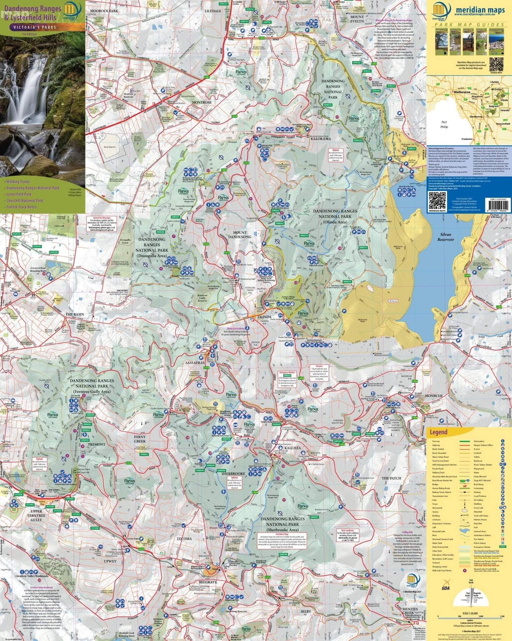
Comprehensive map from Meridian (1:20,000 scale) which covers all the parks in the area including Dandenong Ranges National Park, Churchill National Park and Lysterfield Park. 32 walks are described including the Dandenong Trail and the Dandenong Tourist Track. Shows all tourist sites, local producers, picnic grounds and walking tracks, in and around the parks. Ideal for bushwalkers, day-trippers, mountain bikers and holidaymakers.
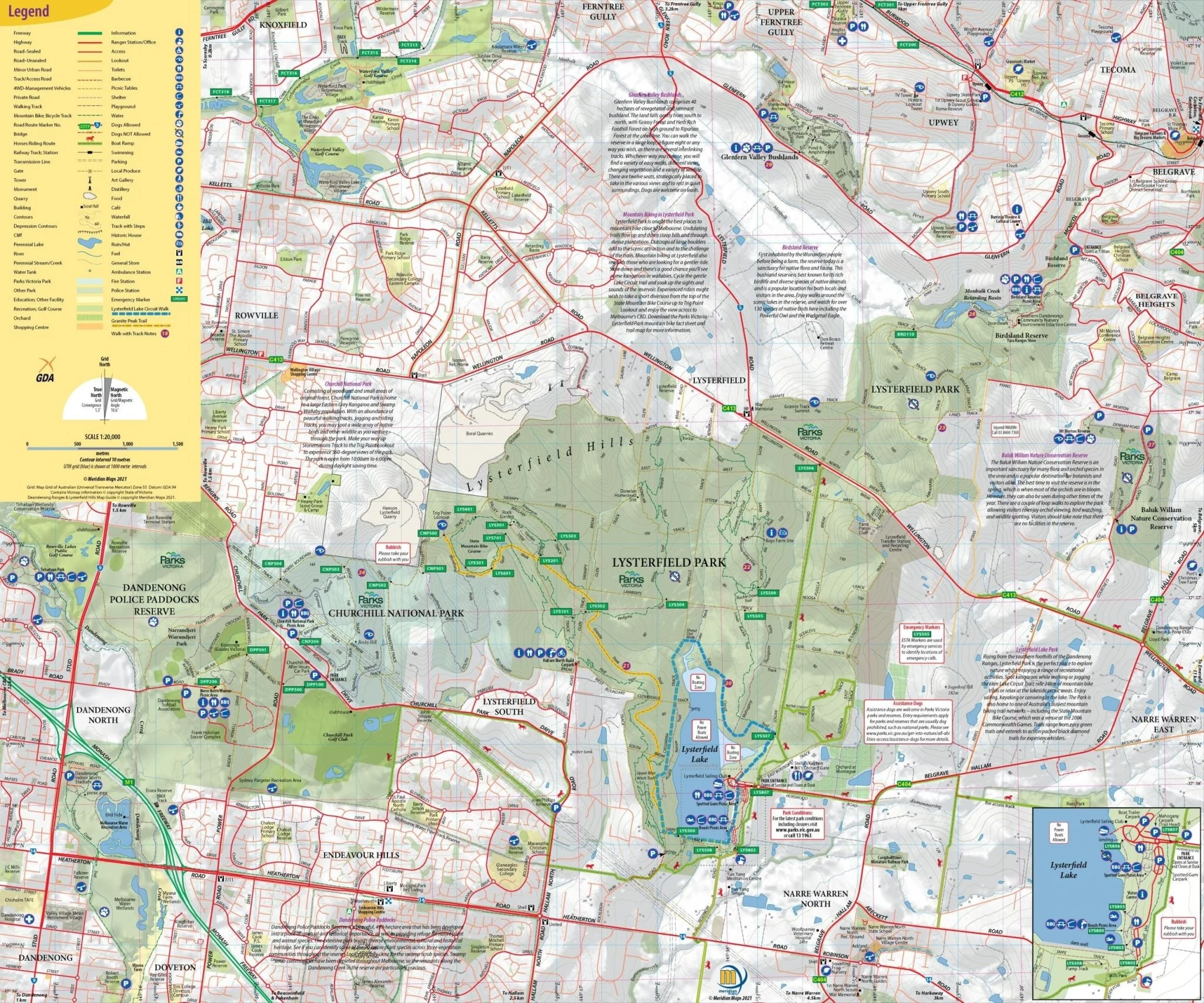
Included in this map; Mt Everlyn, Kalorama, Montrose, Sassafras, Monbulk, Olinda, The Basin, Silvan Reservoir, Sherbrooke, Upper Ferntree Gully, Belgrave, The Patch, Menzies Creek, Belgrave Heights, Dandenong Police Paddocks Reserve, Lysterfield South, Lysterfield Lake, Narre Warren North, Dandenong North and Doveton.
Key Features
- 1:20,000 Scale Maps
- Field and track notes for 32 walking tracks
- Key tracks including; Dandenong Ranges Trail and Dandenong Ranges Tourist Track
- Dandenong Ranges National Park
- Churchill National Park
- Lysterfield Park (superb for mountain biking)
- Tourist information
Key Specifications
Edition: 2nd
Publication Date: 01/12/21
Scale: 1:20,000
Folded size (WxHxD): 100mm x 250mm x 3mm
Flat size (WxH): 600mm x 750mm
Weight: 0.06kgs
More Images
Dandenong Ranges & Lysterfield Hills Map Guide
Comprehensive map from Meridian (1:20,000 scale) which covers all the parks in the area including Dandenong Ranges National Park, Churchill National Park and Lysterfield Park. 32 walks are described including the Dandenong Trail and the Dandenong Tourist Track. Shows all tourist sites, local producers, picnic grounds and walking tracks, in and around the parks. Ideal for bushwalkers, day-trippers, mountain bikers and holidaymakers.
Included in this map; Mt Everlyn, Kalorama, Montrose, Sassafras, Monbulk, Olinda, The Basin, Silvan Reservoir, Sherbrooke, Upper Ferntree Gully, Belgrave, The Patch, Menzies Creek, Belgrave Heights, Dandenong Police Paddocks Reserve, Lysterfield South, Lysterfield Lake, Narre Warren North, Dandenong North and Doveton.
Key Features
- 1:20,000 Scale Maps
- Field and track notes for 32 walking tracks
- Key tracks including; Dandenong Ranges Trail and Dandenong Ranges Tourist Track
- Dandenong Ranges National Park
- Churchill National Park
- Lysterfield Park (superb for mountain biking)
- Tourist information
Key Specifications
Edition: 2nd
Publication Date: 01/12/21
Scale: 1:20,000
Folded size (WxHxD): 100mm x 250mm x 3mm
Flat size (WxH): 600mm x 750mm
Weight: 0.06kgs
Product Information
Product Information
Shipping & Returns
Shipping & Returns
Description
Comprehensive map from Meridian (1:20,000 scale) which covers all the parks in the area including Dandenong Ranges National Park, Churchill National Park and Lysterfield Park. 32 walks are described including the Dandenong Trail and the Dandenong Tourist Track. Shows all tourist sites, local producers, picnic grounds and walking tracks, in and around the parks. Ideal for bushwalkers, day-trippers, mountain bikers and holidaymakers.
Included in this map; Mt Everlyn, Kalorama, Montrose, Sassafras, Monbulk, Olinda, The Basin, Silvan Reservoir, Sherbrooke, Upper Ferntree Gully, Belgrave, The Patch, Menzies Creek, Belgrave Heights, Dandenong Police Paddocks Reserve, Lysterfield South, Lysterfield Lake, Narre Warren North, Dandenong North and Doveton.
Key Features
- 1:20,000 Scale Maps
- Field and track notes for 32 walking tracks
- Key tracks including; Dandenong Ranges Trail and Dandenong Ranges Tourist Track
- Dandenong Ranges National Park
- Churchill National Park
- Lysterfield Park (superb for mountain biking)
- Tourist information
Key Specifications
Edition: 2nd
Publication Date: 01/12/21
Scale: 1:20,000
Folded size (WxHxD): 100mm x 250mm x 3mm
Flat size (WxH): 600mm x 750mm
Weight: 0.06kgs


