Cape York Wall Map
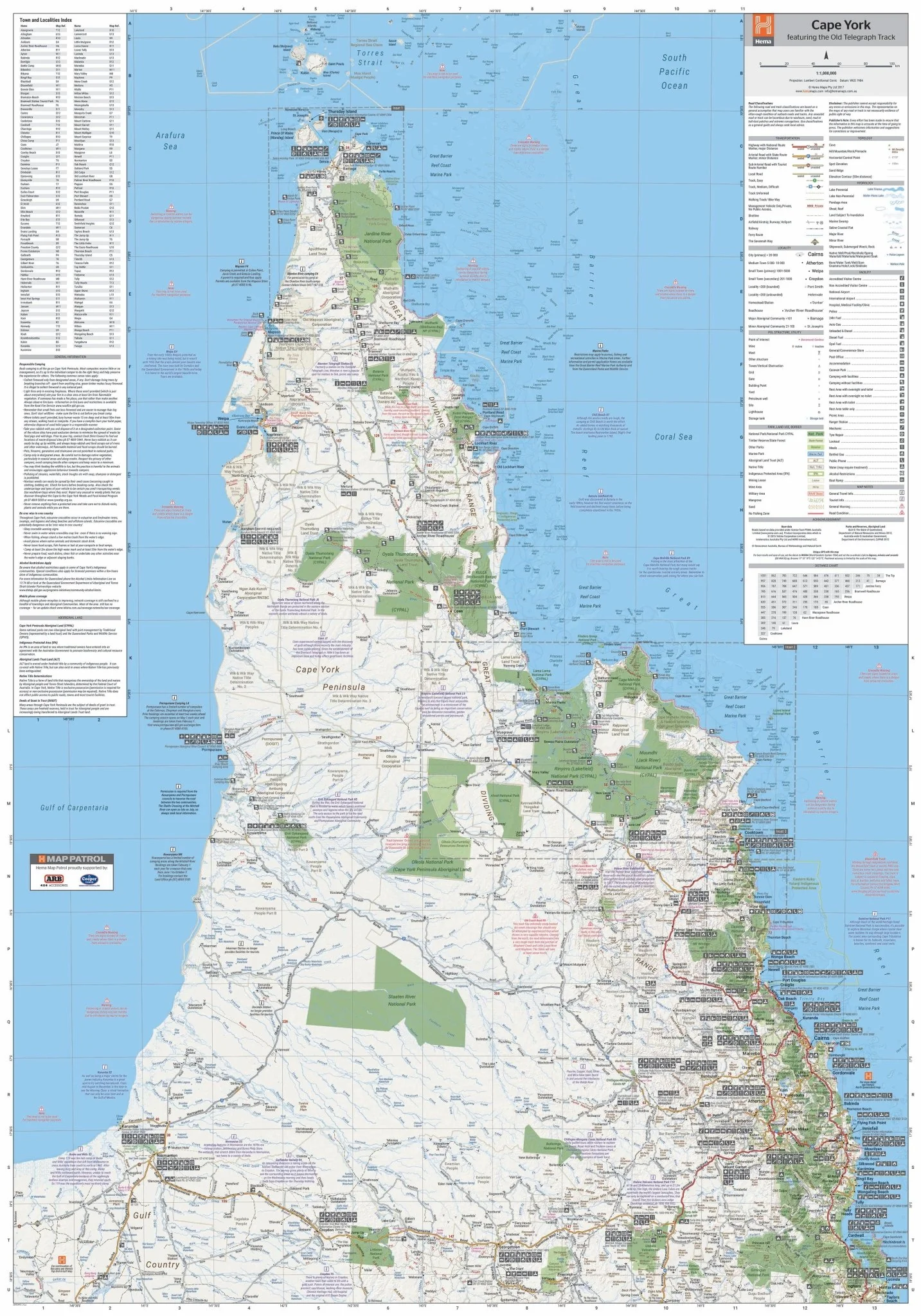
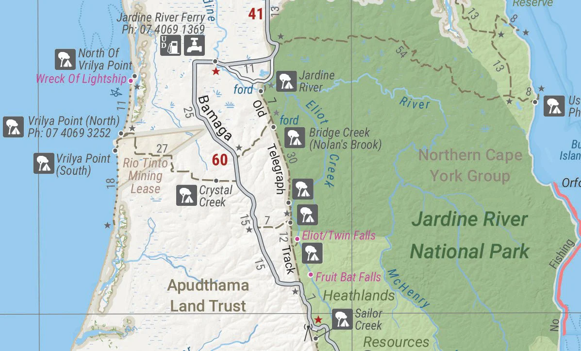
A large wall map that features updated mapping of Cape York that ranges from below Innisfail to the Tip, with numerous points of interest and GPS field-checked 4WD tracks marked on the map.
Available in two finishes at the Megamap - 1000x1430mm size.
Finish
- Laminated encapsulated - high quality produced by Hema Maps
- Photo paper; Satin 255gsm (unlaminated) - high quality produced by Hema Maps
All maps are designed and printed in Australia.
Key Features
- Fully field checked by Hema's Map Patrol
- The old telegraph track clearly marked
- 4WD tracks marked
- Relief shading
- Major National parks
- Distance grid
- Town and Localities Index
- Points of Interest and facilities listed
Key Specifications
Edition: 5th
Publication Date: 01/04/17
Scale: 1:700,000
Flat size (WxH): 1000mm x 1430mm
Weight: 0.45kgs
Want something different. We do custom maps. Email: [email protected]
Original: $90.08
-65%$90.08
$31.53More Images
Cape York Wall Map
A large wall map that features updated mapping of Cape York that ranges from below Innisfail to the Tip, with numerous points of interest and GPS field-checked 4WD tracks marked on the map.
Available in two finishes at the Megamap - 1000x1430mm size.
Finish
- Laminated encapsulated - high quality produced by Hema Maps
- Photo paper; Satin 255gsm (unlaminated) - high quality produced by Hema Maps
All maps are designed and printed in Australia.
Key Features
- Fully field checked by Hema's Map Patrol
- The old telegraph track clearly marked
- 4WD tracks marked
- Relief shading
- Major National parks
- Distance grid
- Town and Localities Index
- Points of Interest and facilities listed
Key Specifications
Edition: 5th
Publication Date: 01/04/17
Scale: 1:700,000
Flat size (WxH): 1000mm x 1430mm
Weight: 0.45kgs
Want something different. We do custom maps. Email: [email protected]
Product Information
Product Information
Shipping & Returns
Shipping & Returns
Description
A large wall map that features updated mapping of Cape York that ranges from below Innisfail to the Tip, with numerous points of interest and GPS field-checked 4WD tracks marked on the map.
Available in two finishes at the Megamap - 1000x1430mm size.
Finish
- Laminated encapsulated - high quality produced by Hema Maps
- Photo paper; Satin 255gsm (unlaminated) - high quality produced by Hema Maps
All maps are designed and printed in Australia.
Key Features
- Fully field checked by Hema's Map Patrol
- The old telegraph track clearly marked
- 4WD tracks marked
- Relief shading
- Major National parks
- Distance grid
- Town and Localities Index
- Points of Interest and facilities listed
Key Specifications
Edition: 5th
Publication Date: 01/04/17
Scale: 1:700,000
Flat size (WxH): 1000mm x 1430mm
Weight: 0.45kgs
Want something different. We do custom maps. Email: [email protected]


