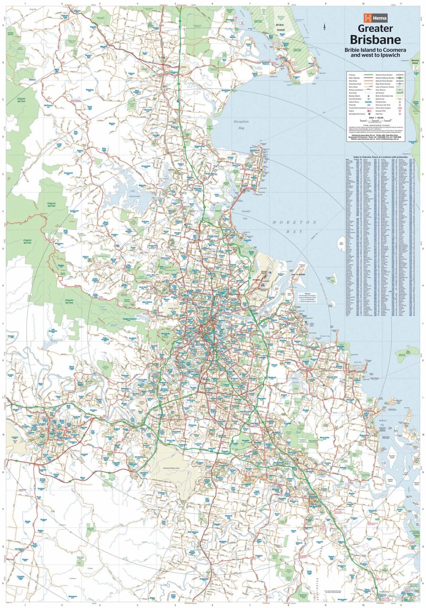
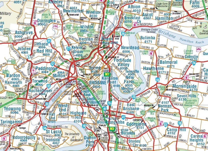
Brisbane and Region Wall Map
A wall map of Greater Brisbane that features highways, major roads, local streets and suburbs in addition to 24-hour fuel, parks and caravan parks marked on the mapping.
Available in two finishes and two sizes as follows:
Finish
- Laminated encapsulated - high quality produced by Hema Maps
- Photo paper; Satin 255gsm (unlaminated) - high quality produced by Hema Maps
Size
- Large Map (WxH) - 700 x 1000mm (scale: 1:100,000)
- Super Map (WxH) - 1000 x 1430mm (scale: 1:70,000)
All maps are designed and printed in Australia.
Key Features
- Large map of Brisbane and the surrounding regions
- Index to Suburbs, Towns and Localities with postcodes
- Points of Interest and facilities listed (including fuel stops and accommodation)
Key Specifications
Edition: 12th
Publication Date: 1/07/2017
Want something different. We do custom maps. Email: [email protected]
Original: $68.45
-65%$68.45
$23.96More Images
Brisbane and Region Wall Map
A wall map of Greater Brisbane that features highways, major roads, local streets and suburbs in addition to 24-hour fuel, parks and caravan parks marked on the mapping.
Available in two finishes and two sizes as follows:
Finish
- Laminated encapsulated - high quality produced by Hema Maps
- Photo paper; Satin 255gsm (unlaminated) - high quality produced by Hema Maps
Size
- Large Map (WxH) - 700 x 1000mm (scale: 1:100,000)
- Super Map (WxH) - 1000 x 1430mm (scale: 1:70,000)
All maps are designed and printed in Australia.
Key Features
- Large map of Brisbane and the surrounding regions
- Index to Suburbs, Towns and Localities with postcodes
- Points of Interest and facilities listed (including fuel stops and accommodation)
Key Specifications
Edition: 12th
Publication Date: 1/07/2017
Want something different. We do custom maps. Email: [email protected]
Product Information
Product Information
Shipping & Returns
Shipping & Returns
Description
A wall map of Greater Brisbane that features highways, major roads, local streets and suburbs in addition to 24-hour fuel, parks and caravan parks marked on the mapping.
Available in two finishes and two sizes as follows:
Finish
- Laminated encapsulated - high quality produced by Hema Maps
- Photo paper; Satin 255gsm (unlaminated) - high quality produced by Hema Maps
Size
- Large Map (WxH) - 700 x 1000mm (scale: 1:100,000)
- Super Map (WxH) - 1000 x 1430mm (scale: 1:70,000)
All maps are designed and printed in Australia.
Key Features
- Large map of Brisbane and the surrounding regions
- Index to Suburbs, Towns and Localities with postcodes
- Points of Interest and facilities listed (including fuel stops and accommodation)
Key Specifications
Edition: 12th
Publication Date: 1/07/2017
Want something different. We do custom maps. Email: [email protected]


