
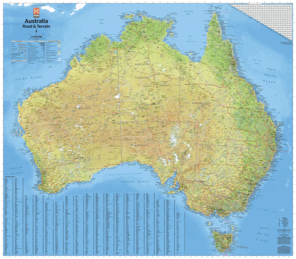
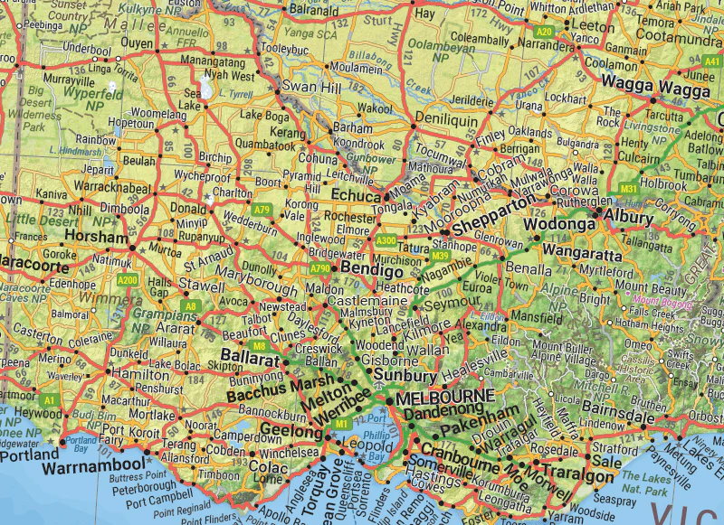
Australia Road and Terrain Wall Map
Wall map of Australia featuring Hema's customary mapping detail with climate zones that are coloured to show variances in temperature and rainfall across the country. Marked on the mapping are major road networks, Outback fuel, distances and major national parks, which in combination with the maps visual appeal make it perfect as either a trip planner, a decorative map or an educational tool.
Available in three finishes and sizes as follows:
Finish
- Laminated paper - mass-produced by a third-party printer
- Laminated encapsulated - high quality produced by Hema Maps
- Photo paper; Satin 255gsm (unlaminated) - high quality produced by Hema Maps
Size
- Large Map (WxH) - 1000 x 875mm (scale: 1:4,500,000)
- Super Map (WxH) - 1350 x 1180mm (scale: 1:3,300,000)
- Mega Map (WxH) - 1666 x 1455mm (scale: 1:1:2,700,000)
All maps are designed and printed in Australia.
Key Features
- Hema's detailed award-winning Australia map
- Road & Terrain colouring for Australia's key climate zones
- Major road networks
- Outback fuel, distances, and major national parks marked
- Index
- Distance grid
Key Specifications
Edition: 2nd
Publication Date: 01/11/22
Want something different. We do custom maps. Email: [email protected]
Original: $43.22
-65%$43.22
$15.13More Images


Australia Road and Terrain Wall Map
Wall map of Australia featuring Hema's customary mapping detail with climate zones that are coloured to show variances in temperature and rainfall across the country. Marked on the mapping are major road networks, Outback fuel, distances and major national parks, which in combination with the maps visual appeal make it perfect as either a trip planner, a decorative map or an educational tool.
Available in three finishes and sizes as follows:
Finish
- Laminated paper - mass-produced by a third-party printer
- Laminated encapsulated - high quality produced by Hema Maps
- Photo paper; Satin 255gsm (unlaminated) - high quality produced by Hema Maps
Size
- Large Map (WxH) - 1000 x 875mm (scale: 1:4,500,000)
- Super Map (WxH) - 1350 x 1180mm (scale: 1:3,300,000)
- Mega Map (WxH) - 1666 x 1455mm (scale: 1:1:2,700,000)
All maps are designed and printed in Australia.
Key Features
- Hema's detailed award-winning Australia map
- Road & Terrain colouring for Australia's key climate zones
- Major road networks
- Outback fuel, distances, and major national parks marked
- Index
- Distance grid
Key Specifications
Edition: 2nd
Publication Date: 01/11/22
Want something different. We do custom maps. Email: [email protected]
Product Information
Product Information
Shipping & Returns
Shipping & Returns
Description
Wall map of Australia featuring Hema's customary mapping detail with climate zones that are coloured to show variances in temperature and rainfall across the country. Marked on the mapping are major road networks, Outback fuel, distances and major national parks, which in combination with the maps visual appeal make it perfect as either a trip planner, a decorative map or an educational tool.
Available in three finishes and sizes as follows:
Finish
- Laminated paper - mass-produced by a third-party printer
- Laminated encapsulated - high quality produced by Hema Maps
- Photo paper; Satin 255gsm (unlaminated) - high quality produced by Hema Maps
Size
- Large Map (WxH) - 1000 x 875mm (scale: 1:4,500,000)
- Super Map (WxH) - 1350 x 1180mm (scale: 1:3,300,000)
- Mega Map (WxH) - 1666 x 1455mm (scale: 1:1:2,700,000)
All maps are designed and printed in Australia.
Key Features
- Hema's detailed award-winning Australia map
- Road & Terrain colouring for Australia's key climate zones
- Major road networks
- Outback fuel, distances, and major national parks marked
- Index
- Distance grid
Key Specifications
Edition: 2nd
Publication Date: 01/11/22
Want something different. We do custom maps. Email: [email protected]


