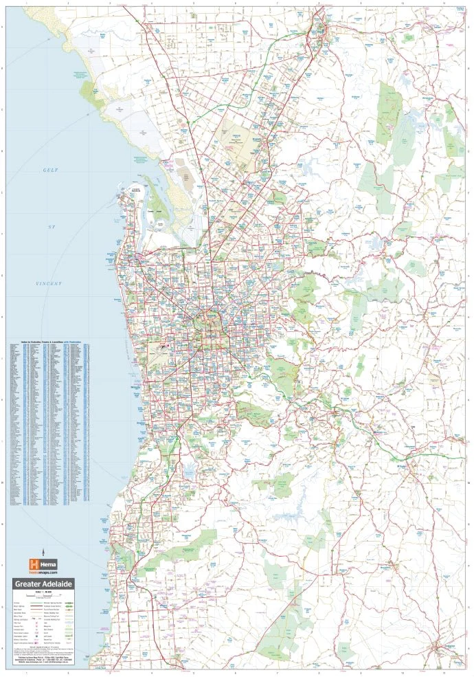
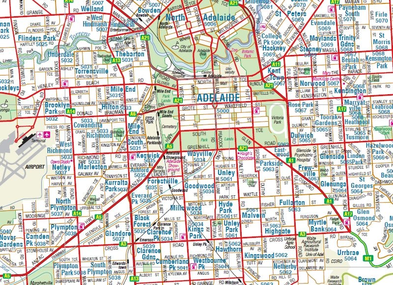
Adelaide and Region Wall Map
A wall map of Greater Adelaide that features highways, major roads, local streets and suburbs in addition to 24-hour fuel, parks and caravan parks marked on the mapping. Available in two sizes and your choice of laminated or unlaminated paper. Printed in Australia.
Available in two finishes and two sizes as follows:
Finish
- Laminated encapsulated - high quality produced by Hema Maps
- Photo paper; Satin 255gsm (unlaminated) - high quality produced by Hema Maps
Size
- Large Map (WxH) - 700 x 1000mm (scale: 1:80,000)
- Super Map (WxH) - 1000 x 1430mm (scale: 1:56,000)
All maps are designed and printed in Australia.
Key Features
- Large map of Adelaide and the surrounding regions
- Index to Suburbs, Towns and Localities with postcodes
- Points of Interest and facilities listed (including fuel stops and accommodation)
Key Specifications
Edition: 9th
Publication Date: 01/09/18
Want something different. We do custom maps. Email: [email protected]
Original: $68.45
-65%$68.45
$23.96More Images
Adelaide and Region Wall Map
A wall map of Greater Adelaide that features highways, major roads, local streets and suburbs in addition to 24-hour fuel, parks and caravan parks marked on the mapping. Available in two sizes and your choice of laminated or unlaminated paper. Printed in Australia.
Available in two finishes and two sizes as follows:
Finish
- Laminated encapsulated - high quality produced by Hema Maps
- Photo paper; Satin 255gsm (unlaminated) - high quality produced by Hema Maps
Size
- Large Map (WxH) - 700 x 1000mm (scale: 1:80,000)
- Super Map (WxH) - 1000 x 1430mm (scale: 1:56,000)
All maps are designed and printed in Australia.
Key Features
- Large map of Adelaide and the surrounding regions
- Index to Suburbs, Towns and Localities with postcodes
- Points of Interest and facilities listed (including fuel stops and accommodation)
Key Specifications
Edition: 9th
Publication Date: 01/09/18
Want something different. We do custom maps. Email: [email protected]
Product Information
Product Information
Shipping & Returns
Shipping & Returns
Description
A wall map of Greater Adelaide that features highways, major roads, local streets and suburbs in addition to 24-hour fuel, parks and caravan parks marked on the mapping. Available in two sizes and your choice of laminated or unlaminated paper. Printed in Australia.
Available in two finishes and two sizes as follows:
Finish
- Laminated encapsulated - high quality produced by Hema Maps
- Photo paper; Satin 255gsm (unlaminated) - high quality produced by Hema Maps
Size
- Large Map (WxH) - 700 x 1000mm (scale: 1:80,000)
- Super Map (WxH) - 1000 x 1430mm (scale: 1:56,000)
All maps are designed and printed in Australia.
Key Features
- Large map of Adelaide and the surrounding regions
- Index to Suburbs, Towns and Localities with postcodes
- Points of Interest and facilities listed (including fuel stops and accommodation)
Key Specifications
Edition: 9th
Publication Date: 01/09/18
Want something different. We do custom maps. Email: [email protected]


