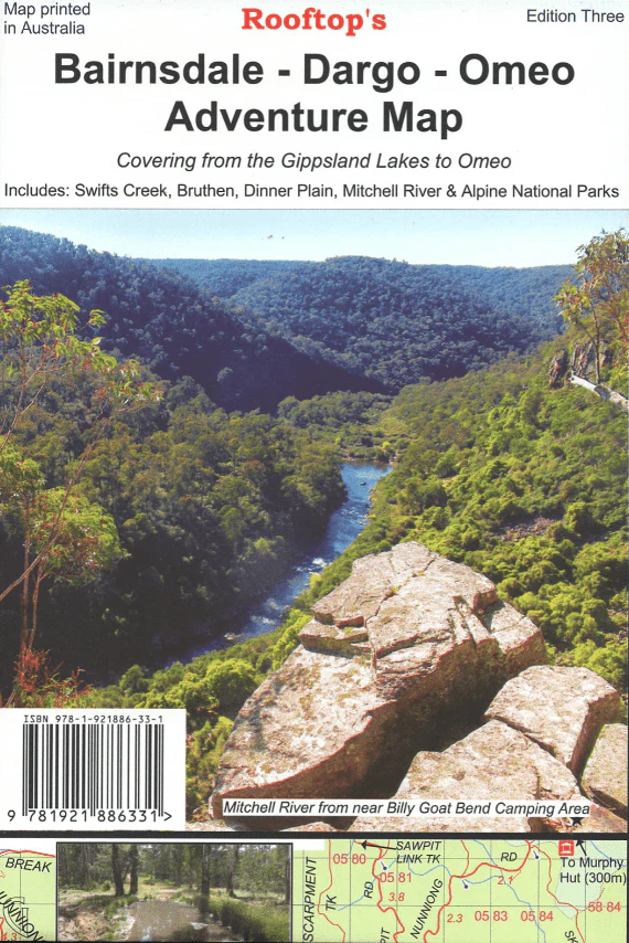
Bairnsdale - Dargo - Omeo Map
3rd edition waterproof map that features the East Gippsland rail Trail which can be followed from Bairnsdale to Colquhoun, south-east of Bruthen. Scale is 1:100,000, and the reverse of the map has a 1:50,000 scale enlargement ‘Dargo – Swifts Creek Forest Activities Map’ with contours. All parks, reserves and state forests are shown, and more than 6000 km of roads and tracks have been plotted using GPS mapping technology - From the Gippsland Lakes into The Victorian High Country.
Key Features
- North: Paynesville, Metung and Lakes Entrance in the south. Dinner Plain, Omeo and Mount Nugong.
- Includes Dargo, Mitchell River National Park, Swifts Creek, Cobungra, Victoria Falls & Cassilis.
- Deptford, Bullumwaal, Mount Baldhead, Haunted Stream and a huge amount of forest in between.
Key Specifications
- Length: 140mm
- Height: 205mm
- Width: 1mm
- Weight: 0.076kg
Original: $12.22
-65%$12.22
$4.28More Images
Bairnsdale - Dargo - Omeo Map
3rd edition waterproof map that features the East Gippsland rail Trail which can be followed from Bairnsdale to Colquhoun, south-east of Bruthen. Scale is 1:100,000, and the reverse of the map has a 1:50,000 scale enlargement ‘Dargo – Swifts Creek Forest Activities Map’ with contours. All parks, reserves and state forests are shown, and more than 6000 km of roads and tracks have been plotted using GPS mapping technology - From the Gippsland Lakes into The Victorian High Country.
Key Features
- North: Paynesville, Metung and Lakes Entrance in the south. Dinner Plain, Omeo and Mount Nugong.
- Includes Dargo, Mitchell River National Park, Swifts Creek, Cobungra, Victoria Falls & Cassilis.
- Deptford, Bullumwaal, Mount Baldhead, Haunted Stream and a huge amount of forest in between.
Key Specifications
- Length: 140mm
- Height: 205mm
- Width: 1mm
- Weight: 0.076kg
Product Information
Product Information
Shipping & Returns
Shipping & Returns
Description
3rd edition waterproof map that features the East Gippsland rail Trail which can be followed from Bairnsdale to Colquhoun, south-east of Bruthen. Scale is 1:100,000, and the reverse of the map has a 1:50,000 scale enlargement ‘Dargo – Swifts Creek Forest Activities Map’ with contours. All parks, reserves and state forests are shown, and more than 6000 km of roads and tracks have been plotted using GPS mapping technology - From the Gippsland Lakes into The Victorian High Country.
Key Features
- North: Paynesville, Metung and Lakes Entrance in the south. Dinner Plain, Omeo and Mount Nugong.
- Includes Dargo, Mitchell River National Park, Swifts Creek, Cobungra, Victoria Falls & Cassilis.
- Deptford, Bullumwaal, Mount Baldhead, Haunted Stream and a huge amount of forest in between.
Key Specifications
- Length: 140mm
- Height: 205mm
- Width: 1mm
- Weight: 0.076kg