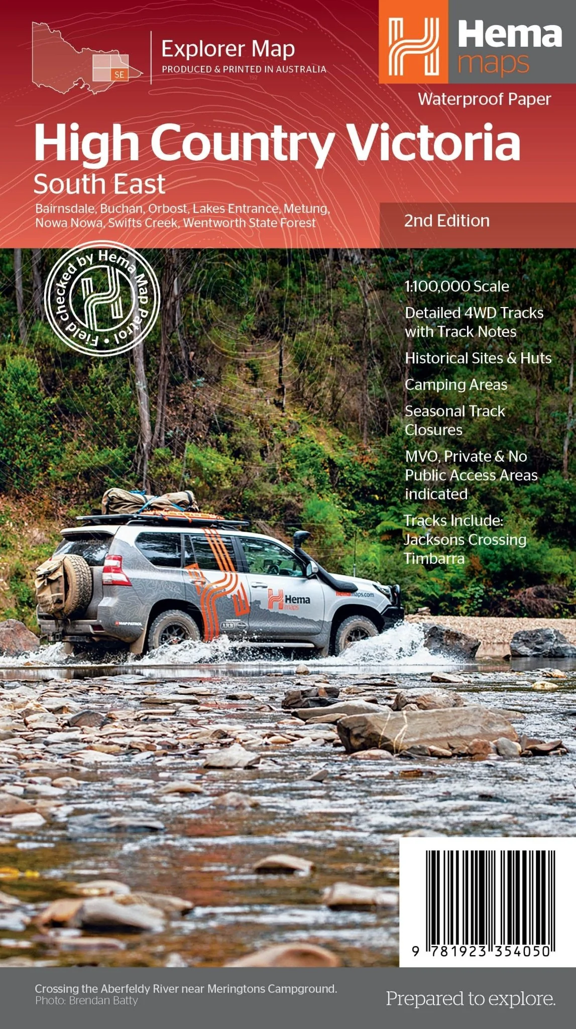
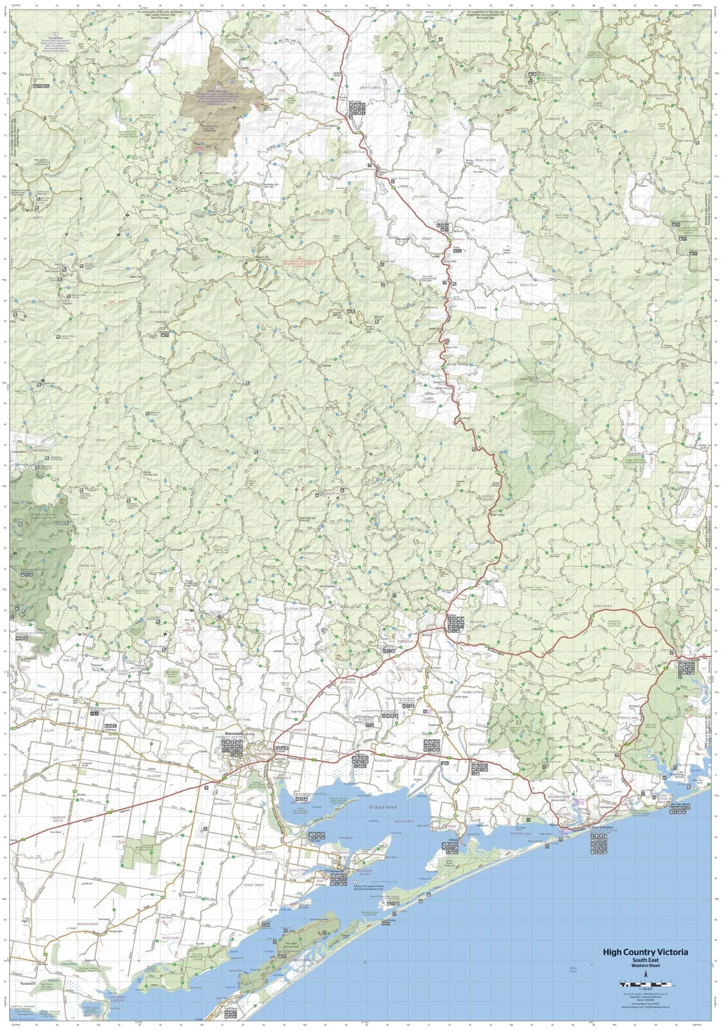
The Victorian High Country - South Eastern Map
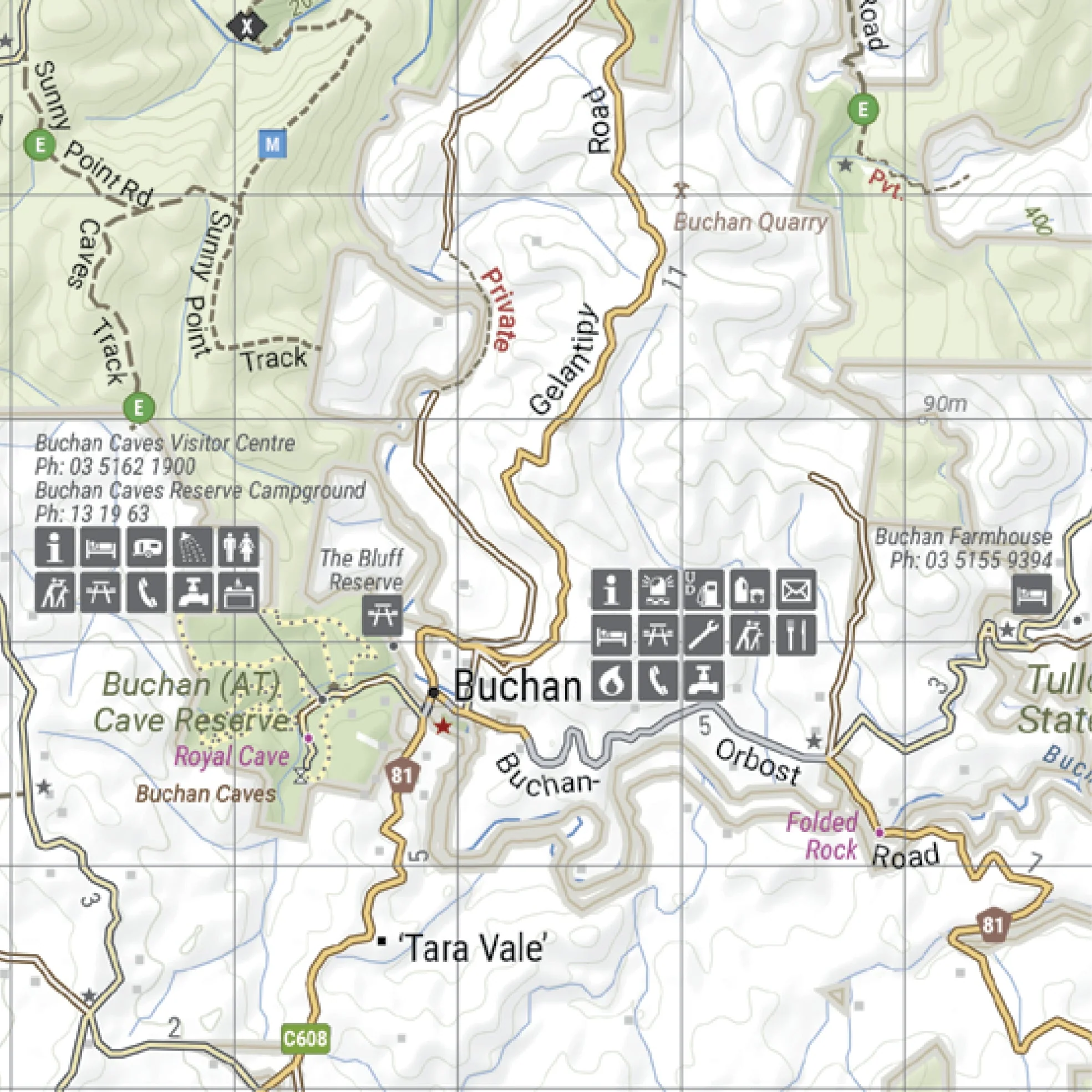
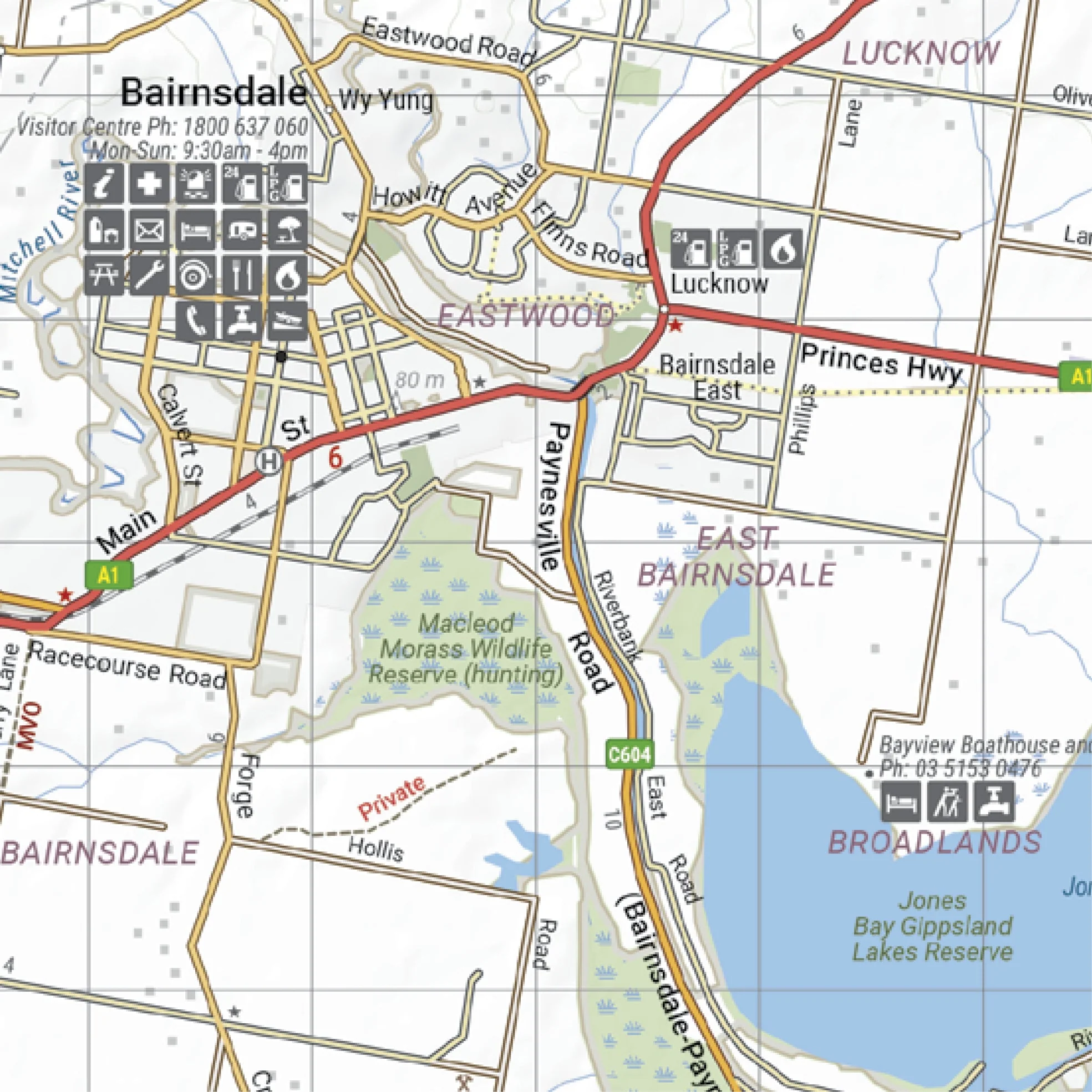
This map is part of Hema's new Victorian High Country Map Series and covers the Southern Lowlands and Lakes Areas. It overlooks Gippsland, Howqua, Jamieson, Licola, Maffra, Lawson, Walhalla, Woods Point and Alpine, Snowy River and Mitchell National Parks. Printed on durable waterproof paper, this map features Hema's iconic mapping and extensive points of interest.
Featuring roads and 4WD tracks field-checked by the Hema Map Patrol for superior accuracy. It combines Hema’s entire database of roads and 4WD tracks with touring points of interest and topographic information. Also included are seasonal track closures, camping areas, old townsites, huts, accommodation and distances. It is a premier destination for four-wheel driving, hiking and outdoor recreation of all sorts.
Key Features
- Detailed 4WD tracks with notes
- Historical sites & old townsites
- Camping areas & huts
- Road distances
- Seasonal snowline and track closures
- Accommodation
- Tracks include; Jacksons Crossing & Timbarra
- Latest bushfire affected areas.
Key Specifications
Edition: 2nd
Publication Date: 17/02/2026
Scale: 1:100,000
Folded size (WxHxD): 140mm x 250mm x 3mm
Flat size (WxH): 700mm x 1000mm
Weight: 0.068kgs
Original: $11.50
-65%$11.50
$4.02More Images
The Victorian High Country - South Eastern Map
This map is part of Hema's new Victorian High Country Map Series and covers the Southern Lowlands and Lakes Areas. It overlooks Gippsland, Howqua, Jamieson, Licola, Maffra, Lawson, Walhalla, Woods Point and Alpine, Snowy River and Mitchell National Parks. Printed on durable waterproof paper, this map features Hema's iconic mapping and extensive points of interest.
Featuring roads and 4WD tracks field-checked by the Hema Map Patrol for superior accuracy. It combines Hema’s entire database of roads and 4WD tracks with touring points of interest and topographic information. Also included are seasonal track closures, camping areas, old townsites, huts, accommodation and distances. It is a premier destination for four-wheel driving, hiking and outdoor recreation of all sorts.
Key Features
- Detailed 4WD tracks with notes
- Historical sites & old townsites
- Camping areas & huts
- Road distances
- Seasonal snowline and track closures
- Accommodation
- Tracks include; Jacksons Crossing & Timbarra
- Latest bushfire affected areas.
Key Specifications
Edition: 2nd
Publication Date: 17/02/2026
Scale: 1:100,000
Folded size (WxHxD): 140mm x 250mm x 3mm
Flat size (WxH): 700mm x 1000mm
Weight: 0.068kgs
Product Information
Product Information
Shipping & Returns
Shipping & Returns
Description
This map is part of Hema's new Victorian High Country Map Series and covers the Southern Lowlands and Lakes Areas. It overlooks Gippsland, Howqua, Jamieson, Licola, Maffra, Lawson, Walhalla, Woods Point and Alpine, Snowy River and Mitchell National Parks. Printed on durable waterproof paper, this map features Hema's iconic mapping and extensive points of interest.
Featuring roads and 4WD tracks field-checked by the Hema Map Patrol for superior accuracy. It combines Hema’s entire database of roads and 4WD tracks with touring points of interest and topographic information. Also included are seasonal track closures, camping areas, old townsites, huts, accommodation and distances. It is a premier destination for four-wheel driving, hiking and outdoor recreation of all sorts.
Key Features
- Detailed 4WD tracks with notes
- Historical sites & old townsites
- Camping areas & huts
- Road distances
- Seasonal snowline and track closures
- Accommodation
- Tracks include; Jacksons Crossing & Timbarra
- Latest bushfire affected areas.
Key Specifications
Edition: 2nd
Publication Date: 17/02/2026
Scale: 1:100,000
Folded size (WxHxD): 140mm x 250mm x 3mm
Flat size (WxH): 700mm x 1000mm
Weight: 0.068kgs