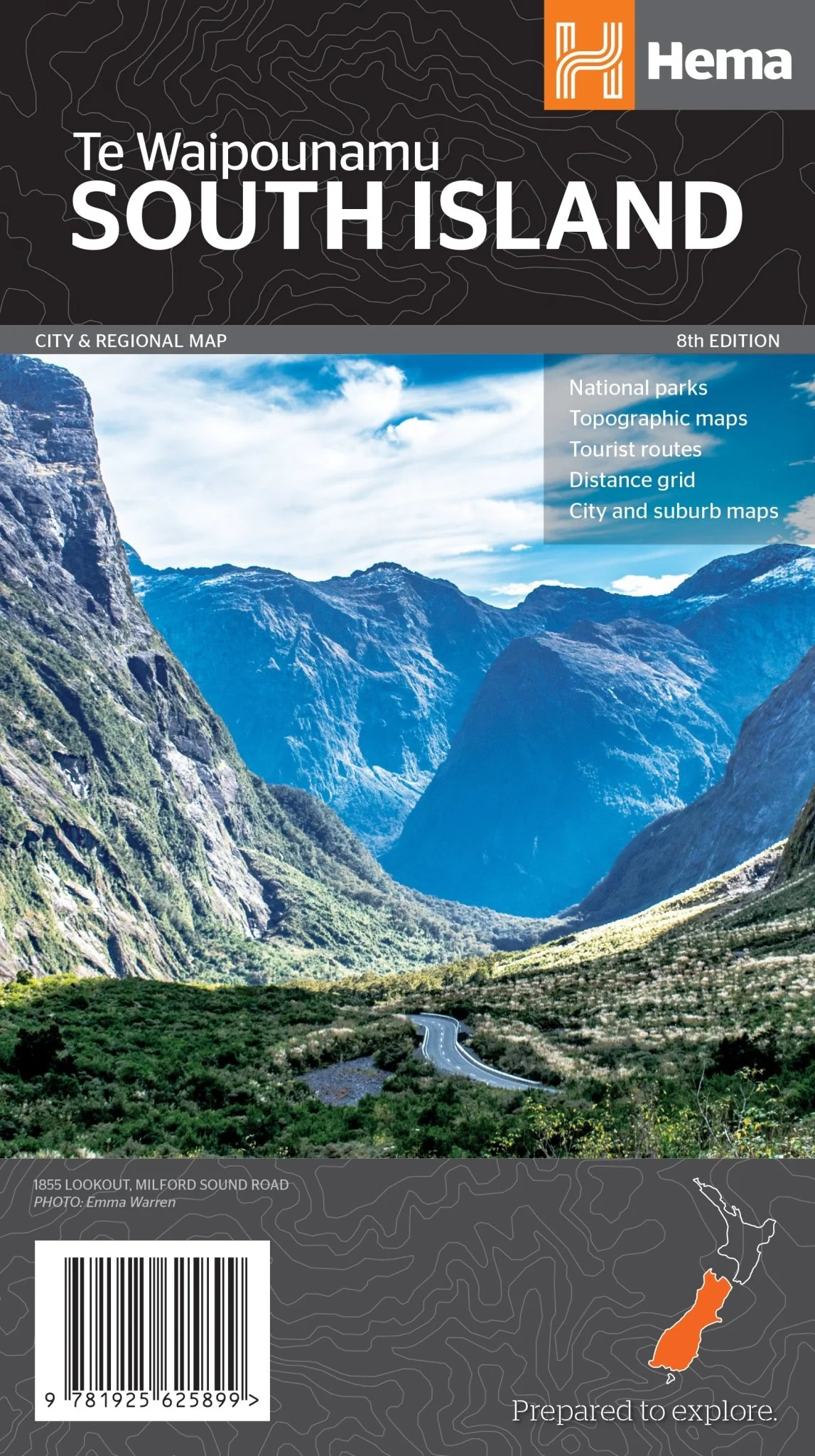
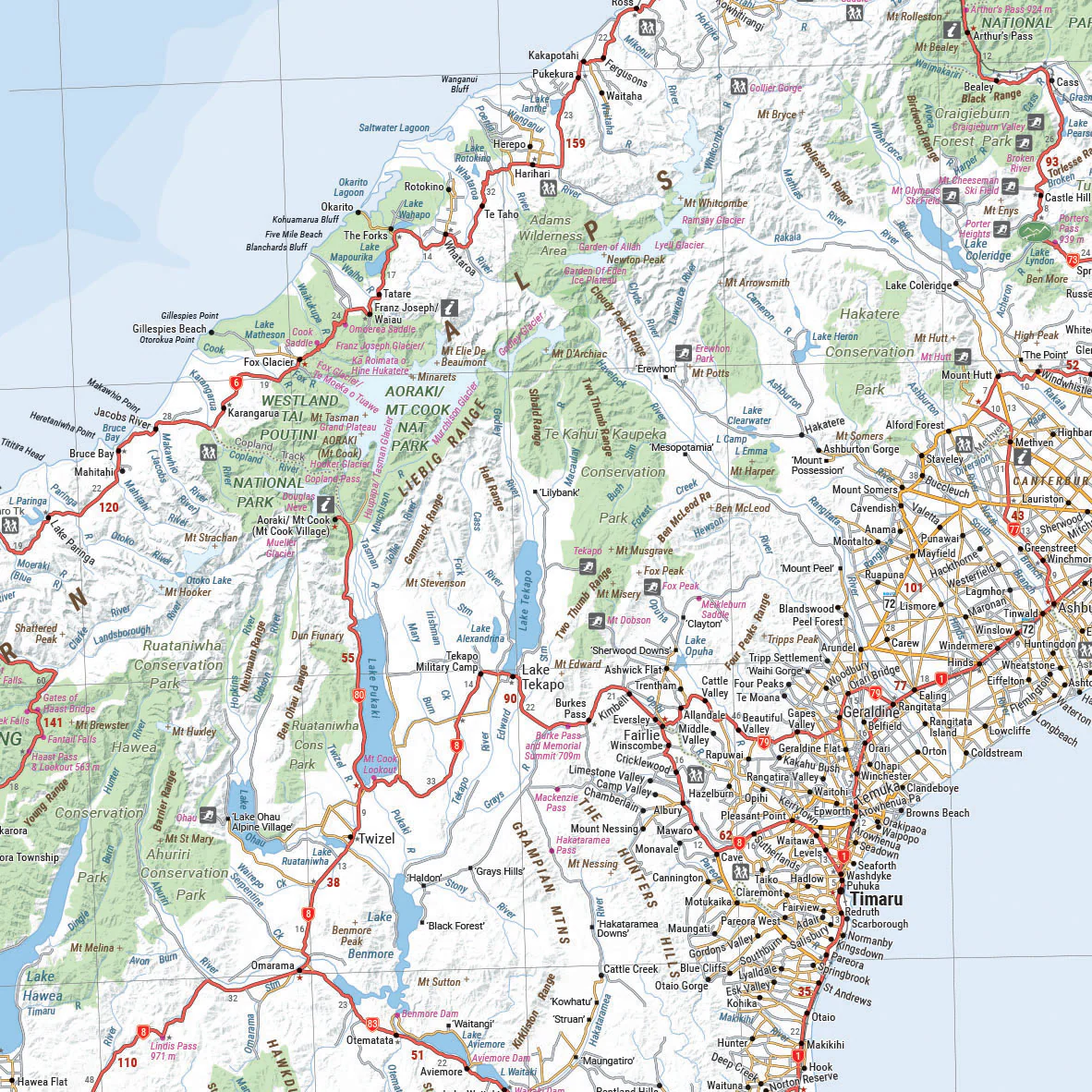
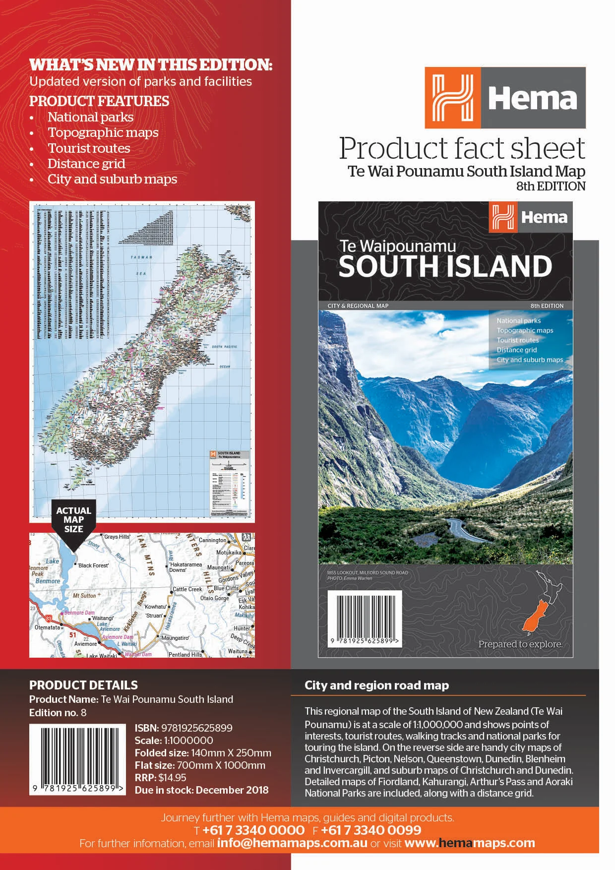
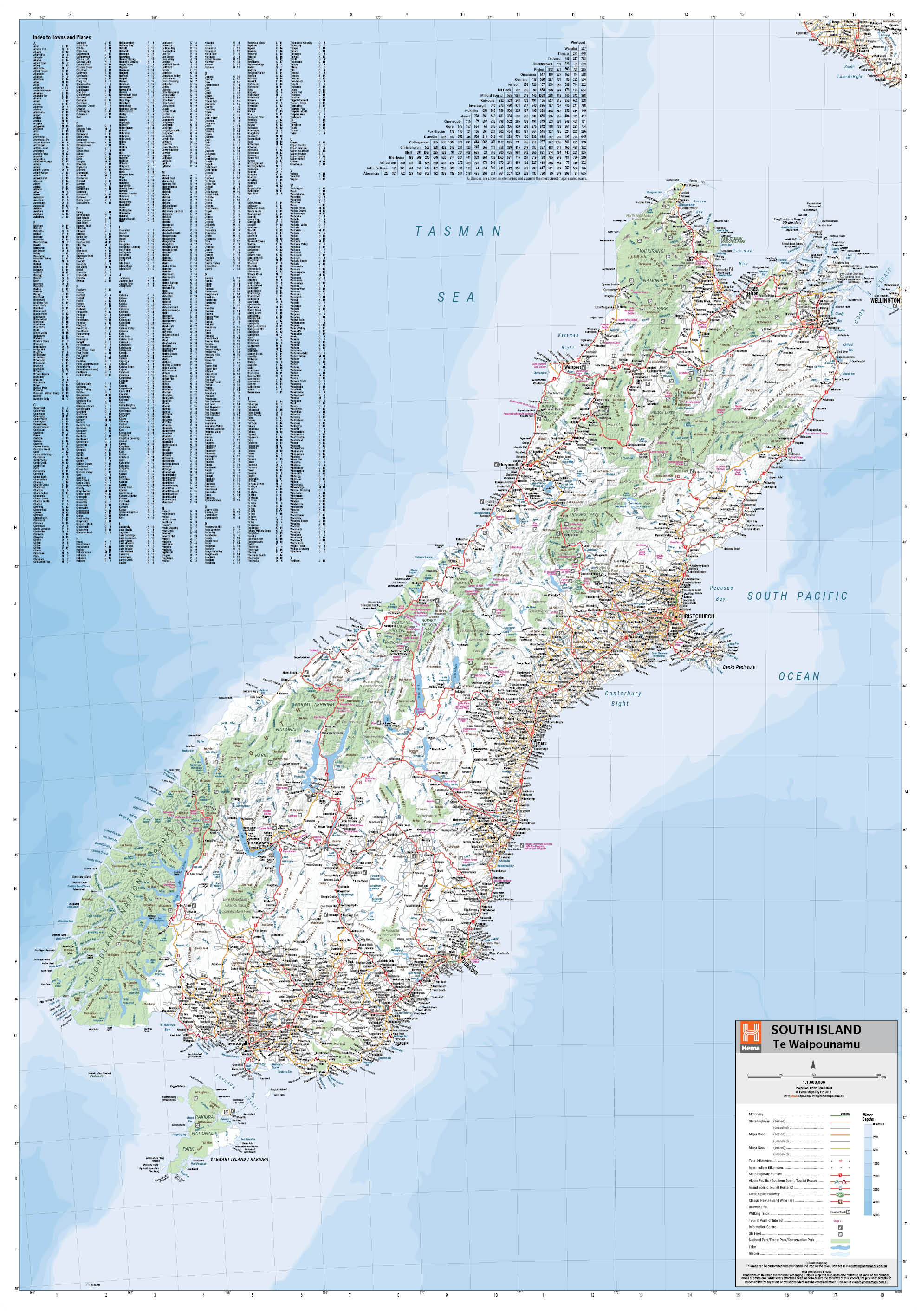
South Island New Zealand Map (Te Waipounamu)
This regional map of the South Island of New Zealand (Te Waipounamu) is at a scale of 1:1,000,000 and
shows points of interests, tourist routes, walking tracks and national parks for touring the island.
On the reverse side are handy city maps of Christchurch, Picton, Nelson, Queenstown, Dunedin,
Blenheim and Invercargill, and suburb maps of Christchurch and Dunedin. It also includes
detailed maps of Fiordland, Kahurangi, Arthur’s Pass and Aoraki National Parks along with a
distance grid.
Product Features
• National parks
• Topographic maps
• Tourist routes
• Distance grid
• City and suburb maps
Key Features
- Points of interest
- Tourist Routes
- National parks
- Walking Tracks
- Auckland and Wellington Suburb Maps
- Distance Grid
- Fully indexed
Key Specifications
Edition: 8th
Publication Date: 19/12/18
Scale: 1:1,000,000
Folded size (WxHxD): 140mm X 250mm x 3mm
Flat size (WxH): 700mm X 1000mm
Weight: 0.09kgs
Original: $11.50
-65%$11.50
$4.02More Images


South Island New Zealand Map (Te Waipounamu)
This regional map of the South Island of New Zealand (Te Waipounamu) is at a scale of 1:1,000,000 and
shows points of interests, tourist routes, walking tracks and national parks for touring the island.
On the reverse side are handy city maps of Christchurch, Picton, Nelson, Queenstown, Dunedin,
Blenheim and Invercargill, and suburb maps of Christchurch and Dunedin. It also includes
detailed maps of Fiordland, Kahurangi, Arthur’s Pass and Aoraki National Parks along with a
distance grid.
Product Features
• National parks
• Topographic maps
• Tourist routes
• Distance grid
• City and suburb maps
Key Features
- Points of interest
- Tourist Routes
- National parks
- Walking Tracks
- Auckland and Wellington Suburb Maps
- Distance Grid
- Fully indexed
Key Specifications
Edition: 8th
Publication Date: 19/12/18
Scale: 1:1,000,000
Folded size (WxHxD): 140mm X 250mm x 3mm
Flat size (WxH): 700mm X 1000mm
Weight: 0.09kgs
Product Information
Product Information
Shipping & Returns
Shipping & Returns
Description
This regional map of the South Island of New Zealand (Te Waipounamu) is at a scale of 1:1,000,000 and
shows points of interests, tourist routes, walking tracks and national parks for touring the island.
On the reverse side are handy city maps of Christchurch, Picton, Nelson, Queenstown, Dunedin,
Blenheim and Invercargill, and suburb maps of Christchurch and Dunedin. It also includes
detailed maps of Fiordland, Kahurangi, Arthur’s Pass and Aoraki National Parks along with a
distance grid.
Product Features
• National parks
• Topographic maps
• Tourist routes
• Distance grid
• City and suburb maps
Key Features
- Points of interest
- Tourist Routes
- National parks
- Walking Tracks
- Auckland and Wellington Suburb Maps
- Distance Grid
- Fully indexed
Key Specifications
Edition: 8th
Publication Date: 19/12/18
Scale: 1:1,000,000
Folded size (WxHxD): 140mm X 250mm x 3mm
Flat size (WxH): 700mm X 1000mm
Weight: 0.09kgs