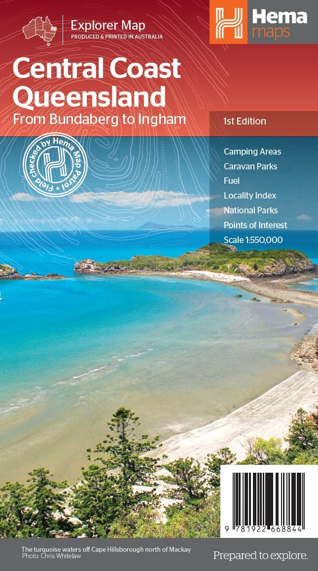
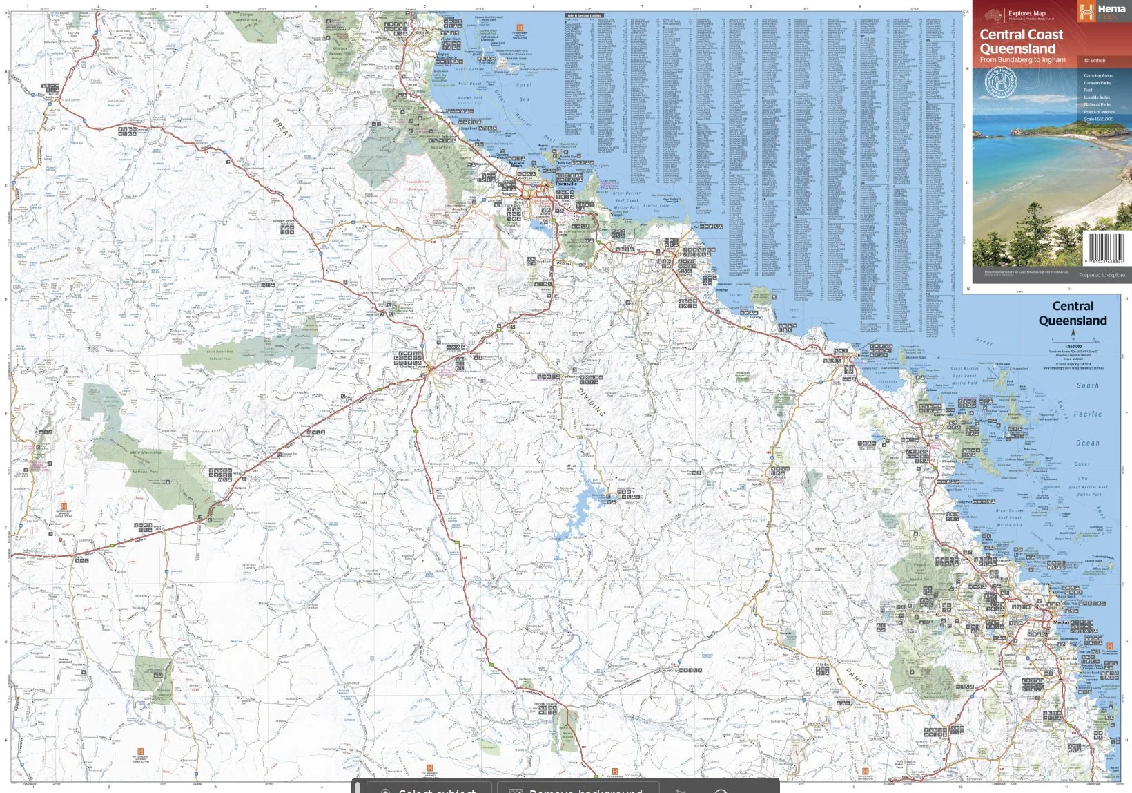
Central Coast Queensland Map
This two-sided regional map showcases the Central Coast of Queensland (1:550,000), extending from just south of Bundaberg up to Ingham in the north and reaching as far west as Clermont. The front side of the map spans from Mackay in the south to Ingham in the north, encompassing Bowen, Ayr, Townsville, and Ingham along the coastline, extending well past Charters Towers to the west. On the reverse side, the map covers the area from Bundaberg in the south to Camila in the north, featuring locations such as Gladstone, Yeppoon, Marlborough along the coast, and Emerald in the west.
Key Features
- Camping Areas
- Caravan Parks
- Fuel
- Locality Index
- National Parks
- Points of interest
Key Specifications
Edition: 1st
Publication Date: 01/15/24
Scale: 1:550,000
Folded size (WxHxD): 140mm x 250mm x 3mm
Flat size (WxH): 700mm x 1000mm
Weight: 0.09kgs
Original: $11.50
-65%$11.50
$4.02More Images
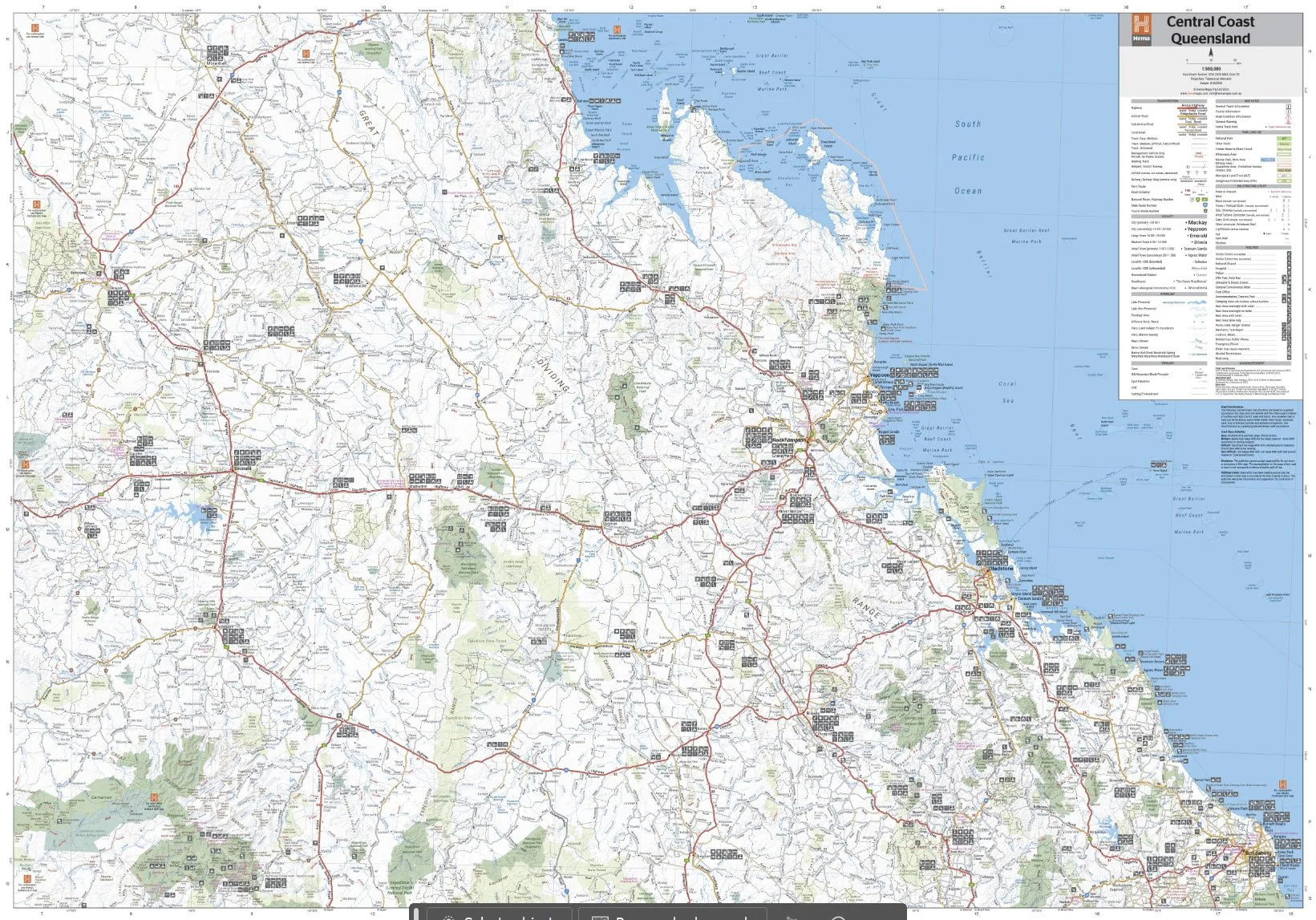
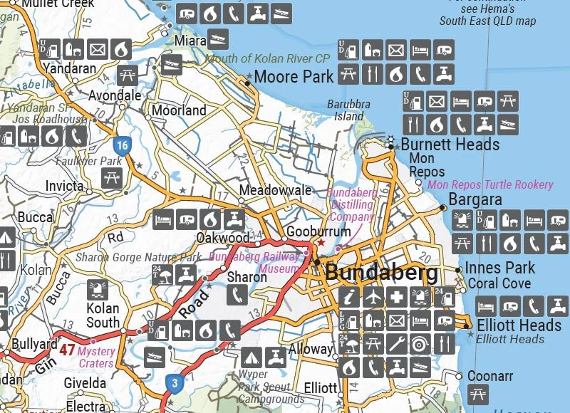
Central Coast Queensland Map
This two-sided regional map showcases the Central Coast of Queensland (1:550,000), extending from just south of Bundaberg up to Ingham in the north and reaching as far west as Clermont. The front side of the map spans from Mackay in the south to Ingham in the north, encompassing Bowen, Ayr, Townsville, and Ingham along the coastline, extending well past Charters Towers to the west. On the reverse side, the map covers the area from Bundaberg in the south to Camila in the north, featuring locations such as Gladstone, Yeppoon, Marlborough along the coast, and Emerald in the west.
Key Features
- Camping Areas
- Caravan Parks
- Fuel
- Locality Index
- National Parks
- Points of interest
Key Specifications
Edition: 1st
Publication Date: 01/15/24
Scale: 1:550,000
Folded size (WxHxD): 140mm x 250mm x 3mm
Flat size (WxH): 700mm x 1000mm
Weight: 0.09kgs
Product Information
Product Information
Shipping & Returns
Shipping & Returns
Description
This two-sided regional map showcases the Central Coast of Queensland (1:550,000), extending from just south of Bundaberg up to Ingham in the north and reaching as far west as Clermont. The front side of the map spans from Mackay in the south to Ingham in the north, encompassing Bowen, Ayr, Townsville, and Ingham along the coastline, extending well past Charters Towers to the west. On the reverse side, the map covers the area from Bundaberg in the south to Camila in the north, featuring locations such as Gladstone, Yeppoon, Marlborough along the coast, and Emerald in the west.
Key Features
- Camping Areas
- Caravan Parks
- Fuel
- Locality Index
- National Parks
- Points of interest
Key Specifications
Edition: 1st
Publication Date: 01/15/24
Scale: 1:550,000
Folded size (WxHxD): 140mm x 250mm x 3mm
Flat size (WxH): 700mm x 1000mm
Weight: 0.09kgs